
Country Philippines Barangays ZIP code 2802 Local time Saturday 12:12 PM | District Lone District of Abra Time zone PST (UTC+8) Area 101.4 km² Province Abra | |
 | ||
Region Cordillera Administrative Region (CAR) Weather 33°C, Wind NW at 8 km/h, 44% Humidity University Abra State Institute of Science and Technology | ||
Lagangilang, officially the Municipality of Lagangilang (Ilocano: Ili ti Lagangilang, Filipino: Bayan ng Lagangilang), is a municipality in the province of Abra in the Cordillera Administrative Region (CAR) of the Philippines. The population was 14,255 at the 2015 census. In the 2016 electoral roll, it had 8,717 registered voters.
Contents
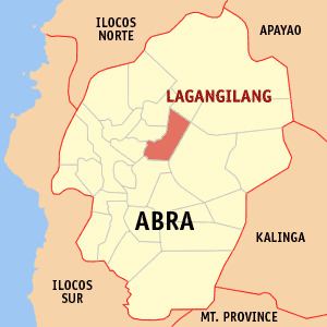
Map of Lagangilang, Abra, Philippines
Geography
Lagangilang is located at 17°37′N 120°44′E.
According to the Philippine Statistics Authority, the municipality has a land area of 101.44 square kilometres (39.17 sq mi) constituting 7000244000000000000♠2.44% of the 4,165.25-square-kilometre- (1,608.21 sq mi) total area of Abra.
Barangays
Lagangilang is politically subdivided into 17 barangays.
Demographics
In the 2015 census, Lagangilang had a population of 14,255. The population density was 140 inhabitants per square kilometre (360/sq mi).
In the 2016 electoral roll, it had 8,717 registered voters.