
Area 10.06 km² | Postal code 691 46 Elevation 160 m Local time Saturday 1:27 AM | |
 | ||
Weather 3°C, Wind NW at 18 km/h, 82% Humidity | ||
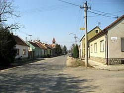
Ladná, until 1950 Lanštorf (German: Rampersdorf) is a village and municipality (obec) in Břeclav District in the South Moravian Region of the Czech Republic.
Map of 691 46 Ladn%C3%A1, Czechia
The municipality covers an area of 10.06 square kilometres (3.88 sq mi), and has a population of 1,197.
Ladná lies approximately 6 kilometres (4 mi) north of Břeclav, 48 km (30 mi) south-east of Brno, and 228 km (142 mi) south-east of Prague.
References
Ladná Wikipedia(Text) CC BY-SA