
Country Canada Constituted January 1, 1950 Postal code(s) J0T 1K0 Area 168.2 km² Local time Friday 3:11 PM Area code 819 | Region Outaouais Time zone EST (UTC−5) Highways Route 323 Population 522 (2011) Province Québec RCM Outaouais | |
 | ||
Weather -9°C, Wind N at 5 km/h, 46% Humidity | ||
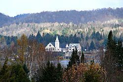
Lac-des-Plages is a town and municipality in the Outaouais region of Quebec, Canada, part of the Papineau Regional County Municipality. It is named after Lac des Plages (French for "Lake of Beaches") which attracts many vacationers with the beauty of its beaches.
Contents
Map of Lac-des-Plages, QC, Canada
History
The community and post office have been identified under several other names, following the name changes of the adjacent lake. It was first known as Lac Rond (Round Lake), Lac Désormeaux (in honor of pioneer Norbert Désormeaux who arrived in the territory in 1890), as well as Lac des Sables (Sand Lake).
In 1950, the Municipality of Lac-des-Plages was formed when its territory detached from the United Township Municipality of Suffolk-et-Addington.
Demographics
Population trend:
Private dwellings occupied by usual residents: 269 (total dwellings: 673)
Mother tongue: