
Country Brunei | District Temburong District | |
 | ||
Time zone Brunei Standard Time (UTC+8) | ||
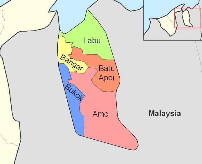
Labu is a mukim in the Temburong District of Brunei. It is located in the north of the Temburong District bordering Brunei Bay to the north, Sarawak (Malaysia) to the east, Mukim Batu Apoi to the south, Mukim Bangar to the south-west and Limbang, Sarawak (Malaysia) to the west. Mukim Labu contains several islands: Pulau Selirong, Pulau Selanjak, Pulau Siarau and Pulau Pituat.
Contents
Map of Labu, Brunei
Areas and divisions
Mukim Labu includes these following areas:
Other locations
Other locations within the mukim include:
Border crossing
A road border crossing into Sarawak, Malaysia is located in this mukim, along the road between Bangar and Lawas. Called the Labu checkpoint, the crossing is located at the Brunei-Malaysia border east of Bangar. The Malaysian checkpoint is called Mengkalap; before the new checkpoint at the border was completed, it operated out of a shoplot in Trusan Bazaar, about 8km from the border towards Lawas.