
Elevation 14 m (46 ft) Postcode 5735–5741 Area 56.17 km² | Established 1 January 1997 Time zone CET (UTC+1) Area code 0492, 0499 Local time Friday 4:00 PM | |
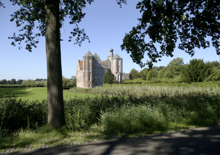 | ||
Weather 12°C, Wind SE at 5 km/h, 48% Humidity Points of interest Croy Castle, Heemkamer Barthold van Hees, Galerij‑Museum‑Bies, Het Kouwenbergs Kerkje | ||
Laarbeek ( pronunciation ) is a municipality located in the province of North Brabant in the south of the Netherlands. It was formed in 1997 from the former municipalities Beek en Donk, Aarle-Rixtel and Lieshout (which included the village Mariahout). Laarbeek is part of the city region 'Samenwerkingsverband Regio Eindhoven', centered on the city of Eindhoven. The town hall is located in Beek en Donk.
Map of Laarbeek, Netherlands
Lieshout is home of the Bavaria Brewery, one of the Netherlands' largest breweries which produces for local and foreign markets.
The Croy Castle is located near the village Aarle-Rixtel.
Dutch Topographic map of the municipality of Laarbeek, June 2015.
References
Laarbeek Wikipedia(Text) CC BY-SA