
Website lasallecountytx.org Founded 1856 Unemployment rate 3.4% (Apr 2015) | Area 3,869 km² Population 7,369 (2013) | |
 | ||
Named for | ||
La Salle County is a county located in the U.S. state of Texas. As of the 2010 census, its population was 6,886. Its county seat is Cotulla. The county was created in 1858 and later organized in 1880. It is named for René-Robert Cavelier, Sieur de La Salle, a 17th-century French explorer.
Contents
- Map of La Salle County TX USA
- Early history
- Geography
- Major highways
- Adjacent counties
- Demographics
- Education
- Cities
- Census designated place
- Unincorporated communities
- Notable people
- References
Map of La Salle County, TX, USA
Early history
The area of present-day La Salle County was occupied by the Coahuiltecan Indians until the 18th century, when they were squeezed out by the Spanish from the south and the Apache from the north. After the Mexican War of Independence, the Mexican government used land grants to encourage settlement, but very few settled in the area. By 1836, the area was entirely populated by Indians.
Between the Texas Revolution and the Mexican War the area of present-day La Salle County lay in the disputed area between the Rio Grande and the Nueces River. Desperadoes ruled the area, as neither the Mexican government nor the Republic of Texas could gain control. The Treaty of Guadalupe Hidalgo assigned the Nueces Strip to Texas in 1848, but outlaws and hostile Indians delayed settlement of the area.
La Salle County was officially formed in 1858 from the Bexar District. The first settlements were established on the road from Laredo to San Antonio. In 1852, the Army established Fort Ewell near present-day Artesia Wells where the road crossed the Nueces River to protect travelers on the road. The fort was abandoned in 1854, and the remaining inhabitants moved to the settlement of Guajoco, located one and a half miles from the fort. By 1871, around 60 people lived in Guajoco, mostly of Mexican descent.
In 1856, William A. Waugh of Ohio established a ranch where the San Antonio–Laredo road crossed Cibolo Creek. His ranch headquarters became a stopping point for travelers and in 1879, a post office was established there with the name Waugh's Rancho. Iuka, an early settlement located 8 miles west of present-day Cotulla, was established in 1868 by several families and served as a stage stop and marketplace for cattle-buyers. The settlement established a post office in 1880. In 1870, the population of La Salle County was 69, and by 1880 it was 789.
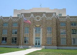
La Salle County was formally organized in 1880 and Stuart's Rancho, near Guajoco, was designated the county seat. In the early 1880s, the International-Great Northern Railroad laid tracks to the county. Around this time, outlaws were gradually eliminated from the area, and the last Indian raid happened in 1878. These changes help bring stability to the county.
With the arrival of the railroads, settlements such as Iuka and Guajoco were abandoned as inhabitants moved near the railroad tracks. Polish immigrant Joseph Cotulla arrived in La Salle County in 1868 and eventually established a large ranching operation. In 1881, Cotulla donated 120 acres of his land to the railroad for the townsite of Cotulla, and the railroad built a depot there in 1882. While Cotulla continued to develop his town, Iuka's postmaster, Jesse Laxton, developed a townsite just across the tracks named La Salle. La Salle was granted a post office in 1881, and in 1882, was designated the temporary county seat. However, Cotulla became the county seat by special election in 1883.
Geography
According to the U.S. Census Bureau, the county has a total area of 1,494 square miles (3,870 km2), of which 7.5 square miles (19 km2) is land and 7.5 square miles (19 km2) (0.5%) is water.
Major highways
Adjacent counties
Demographics
As of the census of 2000, there were 5,866 people, 1,819 households, and 1,351 families residing in the county. The population density was 4 people per square mile (2/km²). There were 2,436 housing units at an average density of 2 per square mile (1/km²). The racial makeup of the county was 81.47% White, 3.55% Black or African American, 0.34% Native American, 0.31% Asian, 12.21% from other races, and 2.13% from two or more races. 77.12% of the population were Hispanic or Latino of any race.
There were 1,819 households out of which 37.70% had children under the age of 18 living with them, 54.70% were married couples living together, 15.40% had a female householder with no husband present, and 25.70% were non-families. 22.90% of all households were made up of individuals and 12.00% had someone living alone who was 65 years of age or older. The average household size was 2.89 and the average family size was 3.45.
In the county, the population was spread out with 29.40% under the age of 18, 10.00% from 18 to 24, 27.70% from 25 to 44, 21.30% from 45 to 64, and 11.60% who were 65 years of age or older. The median age was 33 years. For every 100 females there were 113.50 males. For every 100 females age 18 and over, there were 121.40 males.
The median income for a household in the county was $21,857, and the median income for a family was $25,494. Males had a median income of $20,856 versus $17,339 for females. The per capita income for the county was $9,692. About 28.20% of families and 29.80% of the population were below the poverty line, including 38.50% of those under age 18 and 24.80% of those age 65 or over. The county's per-capita income makes it one of the poorest counties in the United States yet it has one of the highest average incomes of the top 1% in the United States.
Education
Most of La Salle County is served by the Cotulla Independent School District. The Dilley Independent School District serves a small portion of northwestern La Salle County.
Cities
Census-designated place
Unincorporated communities
Notable people
In the early 1920s, the author-folklorist J. Frank Dobie briefly left the University of Texas at Austin to work on his uncle's ranch in La Salle County. His articles about Texas Longhorn cattle helped to prevent their extinction.
Ray Keck, the fifth and current president of Texas A&M International University in Laredo, was born in San Antonio and reared in Cotulla, where his father, Ray Keck, Jr., was president of Stockmen's National Bank.