Country Argentina Founded July 13, 1835 CPA base E3190 Elevation 55 m | Department La Paz Time zone ART (UTC-3) Dialing code +54 3437 Area 119 km² Local time Friday 4:43 AM | |
 | ||
Weather 19°C, Wind S at 19 km/h, 70% Humidity | ||
La Paz is a city in the province of Entre Ríos in the Argentine Mesopotamia. It has about 25,000 inhabitants as per the 2001 census , and is the head town of the department of the same name.
Map of La Paz, Entre Rios, Argentina
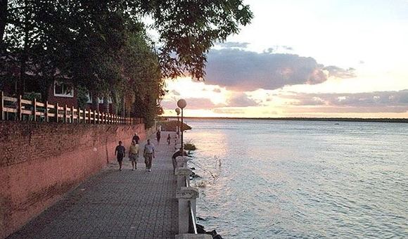
The city lies in the north-west of the province, on the left-hand (eastern) shore of the Paraná River. It was already settled in the 18th century as a natural port, appearing in maps of the time as Cabayú Cuatiá (the name of a stream that empties into the Paraná at this point). It formally became a city on 1 January 1873.
Like other cities in the area, La Paz has a hot springs complex and takes touristic advantage of its river beaches and the possibility of excellent sport fishing, with access to the Curuzú Chalí Provincial Fish Reserve.
References
La Paz, Entre Ríos Wikipedia(Text) CC BY-SA
