
Kanji 宗谷海峡 Russian Пролив Лаперуза | Romanization Sōya Kaikyō Romanization Proliv Laperuza | |
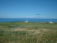 | ||
La Pérouse Strait, or Sōya Strait, is a strait dividing the southern part of the Russian island of Sakhalin (Karafuto) from the northern part of the Japanese island of Hokkaidō, and connecting the Sea of Japan on the west with the Sea of Okhotsk on the east.
The strait is 42 km (26 mi) long and 40 to 140 m (130 to 460 ft) deep. The narrowest part of the strait is in the west between Russia's Cape Krillion and Japan's Cape Soya, which is also the shallowest at only 60 meters deep. A small rocky island, appropriately named Kamen Opasnosti (Russian for "Rock of Danger") is located in the Russian waters in the northeastern part of the strait, 8 miles southeast of the Cape Krillion. Another small island, Bentenjima, lies near the Japanese shore of the strait.
The strait is named after Jean-François de Galaup, comte de Lapérouse, who explored the channel in 1787.
Japan's territorial waters extend to three nautical miles into La Pérouse Strait instead of the usual twelve, reportedly to allow nuclear-armed United States Navy warships and submarines to transit the strait without violating Japan's prohibition against nuclear weapons in its territory.
History
Between 1848 and 1892, American whaleships passed through the strait in the spring and summer as they made their way from the right whale grounds in the Sea of Japan to the Sea of Okhotsk to hunt right and bowhead whales. The ship David Paddack (352 tons), Captain Swain, of Nantucket, was bound home with a full cargo when she wrecked in the strait in 1848.