
Country United States County Allen FIPS code 20-37725 Elevation 315 m Zip code 66751 Local time Thursday 10:40 PM | Time zone Central (CST) (UTC-6) GNIS feature ID 0474511 Area 212 ha Population 561 (2013) Area code 620 | |
 | ||
Weather 8°C, Wind N at 24 km/h, 44% Humidity | ||
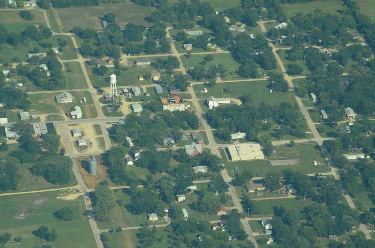
La Harpe is a city in Allen County, Kansas, United States. As of the 2010 census, the city population was 578.
Contents
Map of La Harpe, KS 66751, USA
History
La Harpe was founded by the Fort Scott, Wichita & Western Railroad company (later the Missouri Pacific), and was platted in 1881. It was named after La Harpe, Illinois and they both commemorate a prominent French explorer of the southern Great Plains of North America, Bernard de la Harpe
When natural gas was discovered in the immediate vicinity in 1899 the city began to grow more rapidly and soon rose to be a city of importance. It was incorporated as a city of the second class, and in 1910 had some of the largest zinc smelters in the world, two banks, an opera house, several good mercantile establishments, a newspaper, and all the municipal improvements usually found in cities of that class. The population that year was 2,080. Its post office, first opened in November 1881, was authorized to issue international money orders, and two rural routes supplied mail to the surrounding country.
Geography
La Harpe is located at 37°54′56″N 95°17′59″W (37.915631, -95.299729). Situated along U.S. Route 54 in the central part of Allen County, La Harpe is about 5½ miles east of the city of Iola (the county seat), 2½ miles east of Gas, and about seven miles west of the junction of U.S. Routes 54 and 59 and the city of Moran.
According to the United States Census Bureau, the city has a total area of 0.82 square miles (2.12 km2), all of it land.
2010 census
As of the census of 2010, there were 578 people, 234 households, and 161 families residing in the city. The population density was 704.9 inhabitants per square mile (272.2/km2). There were 273 housing units at an average density of 332.9 per square mile (128.5/km2). The racial makeup of the city was 93.6% White, 1.4% African American, 1.2% Native American, 0.9% Asian, 1.0% from other races, and 1.9% from two or more races. Hispanic or Latino of any race were 1.6% of the population.
There were 234 households of which 28.6% had children under the age of 18 living with them, 49.6% were married couples living together, 12.0% had a female householder with no husband present, 7.3% had a male householder with no wife present, and 31.2% were non-families. 26.1% of all households were made up of individuals and 12% had someone living alone who was 65 years of age or older. The average household size was 2.47 and the average family size was 2.91.
The median age in the city was 42.2 years. 22.3% of residents were under the age of 18; 9% were between the ages of 18 and 24; 24.1% were from 25 to 44; 27.9% were from 45 to 64; and 16.8% were 65 years of age or older. The gender makeup of the city was 52.1% male and 47.9% female.
2000 census
As of the census of 2000, there were 706 people, 268 households, and 191 families residing in the city. The population density was 819.4 people per square mile (317.0/km²). There were 298 housing units at an average density of 345.9 per square mile (133.8/km²). The racial makeup of the city was 93.77% White, 0.99% African American, 2.12% Native American, and 3.12% from two or more races. Hispanic or Latino of any race were 0.85% of the population.
There were 268 households out of which 35.8% had children under the age of 18 living with them, 57.1% were married couples living together, 9.7% had a female householder with no husband present, and 28.4% were non-families. 23.5% of all households were made up of individuals and 11.2% had someone living alone who was 65 years of age or older. The average household size was 2.63 and the average family size was 3.08.
In the city, the population was spread out with 28.6% under the age of 18, 9.8% from 18 to 24, 29.6% from 25 to 44, 21.4% from 45 to 64, and 10.6% who were 65 years of age or older. The median age was 34 years. For every 100 females there were 103.5 males. For every 100 females age 18 and over, there were 100.8 males.
The median income for a household in the city was $24,219, and the median income for a family was $32,981. Males had a median income of $22,102 versus $16,058 for females. The per capita income for the city was $12,196. About 8.9% of families and 13.4% of the population were below the poverty line, including 16.1% of those under age 18 and 11.8% of those age 65 or over.
Education
La Harpe is a part of USD 257 Iola. The Iola High School mascot is Mustangs.
La Harpe schools were closed through school unification. The La Harpe High School mascot was La Harpe Panthers.