
Country United States FIPS code 29-39764 Elevation 149 m Population 930 (2013) Area code 655 | Time zone Central (CST) (UTC-6) GNIS feature ID 0735680 Zip code 63448 Local time Thursday 10:24 PM | |
 | ||
Weather 4°C, Wind N at 18 km/h, 54% Humidity Area 4.817 km² (4.04 km² Land / 78 ha Water) | ||
La Grange is a city in Lewis County, Missouri, United States. The population was 931 at the 2010 census. Since the 1960 census, the population has been dwindling. It is part of the Quincy, IL–MO Micropolitan Statistical Area.
Contents
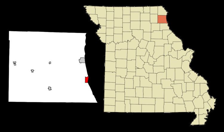
- Map of La Grange MO 63448 USA
- History
- Geography
- 2010 census
- 2000 census
- Current Administration
- Notable residents
- References
Map of La Grange, MO 63448, USA
History
La Grange was founded in 1830. A post office called La Grange has been in operation since 1833.
In 1885, the Supreme Court ruled against the city in Cole v. La Grange. The court found that the city could only use eminent domain powers for public purposes and not to specifically benefit the La Grange Iron and Steel Company.
In 1858 the Southern Baptists opened the LaGrange Male and Female Seminary. It later became LaGrange College, with a two-year junior college program.
In 1928 it moved to Hannibal as Hannibal–LaGrange College (now Hannibal–LaGrange University).
In 2002, the Mark Twain Casino opened in a stationary riverboat.
In 2010, Officer Doug Howell of the LaGrange PD shot and killed a restrained dog in an incident that LaGrange is perhaps best known for today. The city ultimately settled a lawsuit on the matter for $50,000. Officer Howell remains employed.
The First Presbyterian Church, William Gray House, Dr. J.A. Hay House, Joseph Hipkins House, John McKoon House, Fred Rhoda House, and A.C. Waltman House are listed on the National Register of Historic Places.
Geography
La Grange is located at 40°2′32″N 91°30′2″W (40.042347, -91.500440). According to the United States Census Bureau, the city has a total area of 1.86 square miles (4.82 km2), of which, 1.56 square miles (4.04 km2) is land and 0.30 square miles (0.78 km2) is water.
2010 census
As of the census of 2010, there were 931 people, 403 households, and 257 families residing in the city. The population density was 596.8 inhabitants per square mile (230.4/km2). There were 461 housing units at an average density of 295.5 per square mile (114.1/km2). The racial makeup of the city was 86.6% White, 9.7% African American, 0.3% Native American, 0.1% Asian, 0.2% from other races, and 3.1% from two or more races. Hispanic or Latino of any race were 0.9% of the population.
There were 403 households of which 31.3% had children under the age of 18 living with them, 45.7% were married couples living together, 13.6% had a female householder with no husband present, 4.5% had a male householder with no wife present, and 36.2% were non-families. 29.8% of all households were made up of individuals and 11.4% had someone living alone who was 65 years of age or older. The average household size was 2.31 and the average family size was 2.84.
The median age in the city was 39.1 years. 24.3% of residents were under the age of 18; 7.1% were between the ages of 18 and 24; 24.1% were from 25 to 44; 29.2% were from 45 to 64; and 15.1% were 65 years of age or older. The gender makeup of the city was 48.2% male and 51.8% female.
2000 census
As of the census of 2000, there were 1,000 people, 435 households, and 267 families residing in the city. The population density was 719.7 people per square mile (277.8/km²). There were 512 housing units at an average density of 368.5 per square mile (142.2/km²). The racial makeup of the city was 86.80% White, 11.10% African American, 0.30% Native American, 0.40% from other races, and 1.40% from two or more races. Hispanic or Latino of any race were 0.60% of the population.
There were 435 households out of which 27.4% had children under the age of 18 living with them, 48.7% were married couples living together, 8.7% had a female householder with no husband present, and 38.6% were non-families. 32.0% of all households were made up of individuals and 17.7% had someone living alone who was 65 years of age or older. The average household size was 2.30 and the average family size was 2.90.
In the city the population was spread out with 24.5% under the age of 18, 7.9% from 18 to 24, 26.7% from 25 to 44, 23.8% from 45 to 64, and 17.1% who were 65 years of age or older. The median age was 38 years. For every 100 females there were 87.6 males. For every 100 females age 18 and over, there were 85.5 males.
The median income for a household in the city was $30,938, and the median income for a family was $38,672. Males had a median income of $26,458 versus $20,897 for females. The per capita income for the city was $15,399. About 7.3% of families and 12.2% of the population were below the poverty line, including 17.3% of those under age 18 and 7.3% of those age 65 or over.
Current Administration
Mayor: Mike Lowe
North Ward Councilpersons: Mike Lowe & Theresa Gunsauls
Middle Ward Councilpersons: David Burbridge & Rita FARR Cox
South Ward Councilpersons: Ronald Lewis & Kent Powers
City Administrator: City Attorney: Jeff Curl
Deputy City Attorney: TBA
City Clerk: Patty Spindler, CMC, CCA
Finance Officer: Kim Schneider
Fire Chief: Henry Gunsauls
Police Chief: Larry Penn
Waste & Water Superintendent: Grant Kennedy