
Time zone CET (UTC+1) Area 10.57 km² Population 519 (2014) | Elevation 252 m Local time Thursday 12:01 AM | |
 | ||
Weather 2°C, Wind W at 6 km/h, 74% Humidity | ||
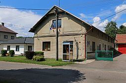
Lípa nad Orlicí is a village and municipality in Rychnov nad Kněžnou District in the Hradec Králové Region of the Czech Republic. It is located 20 kilometres (12 mi) southeast of Hradec Králové and 120 kilometres (75 mi) east of Prague.
Map of 517 21 L%C3%ADpa nad Orlic%C3%AD, Czechia
The municipality covers an area of 10.57 square kilometres (4.08 sq mi) and as of 2014 it had a population of 519. First written notice about the village is from year 1396.
The village of Dlouhá Louka is an administrative part of Lípa nad Orlicí.
References
Lípa nad Orlicí Wikipedia(Text) CC BY-SA