
Demonym(s) atzubià, atzubiana Distance to Alicante: 104 km (65 mi) Elevation 102 m Population 627 (2014) | Postcode 03786 Website www.atzubia-forna.org Area 14.73 km² Postal code 03786 Local time Monday 2:22 AM | |
 | ||
Weather 13°C, Wind NW at 2 km/h, 69% Humidity | ||
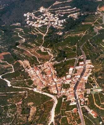
L'Atzúbia ([laˈdzubia]) or Adsubia ([aðˈsuβja]) is a municipality in the comarca of Marina Alta in the north of the province of Alicante, in the Valencian Community, Spain.
Map of 03786 L'Atz%C3%BAbia, Alicante, Spain
It is enclaved in the Pego Valley. The neighbouring municipalities are: Vilallonga and Oliva to the north, Oliva and Pego to the east, La Vall de Gallinera and Vilallonga to the west; and La Vall de Gallinera and Pego to the south.
References
L'Atzúbia Wikipedia(Text) CC BY-SA