
Country Kyrgyzstan District Jeti-Ögüz District Local time Sunday 10:57 PM | Region Issyk-Kul Region Elevation 1,770 m Population 12,150 (2009) | |
 | ||
Weather -5°C, Wind SW at 11 km/h, 100% Humidity | ||
Kyzyl-Suu (formerly known as Pokrovka) is a village in the Issyk-Kul Region of Kyrgyzstan. About 10km inland from Lake Issyk Kul on the A363 highway between Jeti-Ögüz resort and Barskoon, it is the capital of Jeti-Ögüz District. Its population was 12,150 in 2009.
Map of Kyzyl Suu, Kyrgyzstan
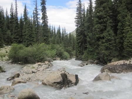
At the head of the Chong Kyzyl-Suu ('little red water') valley, it is a base for trekking into the 14,000 foot mountains to the south. Kyzyl-Suu is named for the "Kyzyl-Suu" river that runs through it. Kyzyl-Suu literally translates to "red water", in reference to the red clay which stains the water during periods of heavy rain.
References
Kyzyl-Suu, Kyrgyzstan Wikipedia(Text) CC BY-SA