
Area 134 km² Local time Sunday 10:40 AM | Phone number 0195-42-2111 Population 6,145 (Feb 2014) | |
 | ||
Address Ihonai dai-10 jiwari 11-6, Kunohe-mura, Kunohe-gun, Iwate 028-6502 Weather 8°C, Wind W at 21 km/h, 55% Humidity | ||
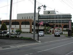
Kunohe (九戸村, Kunohe-mura) is a village located in Kunohe District, Iwate, Japan. As of February 2014, the village had an estimated population of 6,145 and a population density of 45.8 persons per km2. The total area was 134.05 km2.
Contents
- Map of Kunohe Kunohe District Iwate Prefecture Japan
- Geography
- Neighboring municipalities
- History
- Economy
- Transportation
- Highway
- References
Map of Kunohe, Kunohe District, Iwate Prefecture, Japan
Geography
Kunohe is located in north-central Iwate Prefecture, surrounded by the Kitakami Mountains.
Neighboring municipalities
History
The area of present-day Kunohe was part of ancient Mutsu Province, dominated by the Nambu clan during the Edo period, who ruled Hachinohe Domain under the Tokugawa shogunate. The villages of Toda, ibonai and Esashika within Kita-Kunohe District were created on April 1, 1889. Kita-Kunohe District and Minami-Kunohe Districts merged to form Kunohe District on April 1, 1897. The three villages merged to form the modern village of Kunohe on April 1, 1955.
Economy
The economy of Kunohe is based on agriculture, the production of charcoal and animal husbandry, primarily poultry.
Transportation
Kunohe is not served by any train routes.