
Country India District South 24 Parganas Assembly constituency Kulpi Elevation 4 m Population 283,197 (2011) | State West Bengal Parliamentary constituency Mathurapur Time zone IST (UTC+5.30) Area 210.8 km² Area code 03224 | |
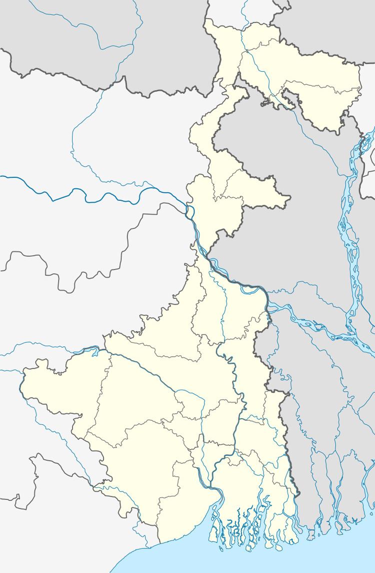 | ||
Kulpi is a community development block that forms an administrative division in Diamond Harbour subdivision of South 24 Parganas district in the Indian state of West Bengal.
Contents
Land reforms
During 1946-1950 the Tebhaga movement in several parts of the 24 Parganas district led to the enactment of the Bargadari Act. Although the Bargadari Act of 1950 recognised the rights of bargadars to a higher share of crops from the land that they tilled, it was not implemented. Large tracts, beyond the prescribed limit of land ceiling, remained with the rich landlords. In 1967, West Bengal witnessed peasant uprising, against non-implementation of land reforms legislation, starting from Kheyadaha gram panchayat in Sonarpur CD Block. From 1977 onwards major land reforms took place in West Bengal under the Left Front government. Land in excess of land ceiling was acquired and distributed amongst the peasants. Subsequently, “Operation Barga” was aimed at securing tenancy rights for the peasants. In Kulpi CD Block 3,855.09 acres of land was acquired and vested. Out of this 1,187.58 acres or 30.81% of the vested land was distributed. The total number of patta holders was 4,769.
Location
Kulpi is located at 22°05′N 88°14′E.
Kulpi CD Block is bounded by Diamond Harbour I and Magrahat I CD Blocks in the north, Mandirbazar, Mathurapur I and Patharpratima CD Blocks in east, Kakdwip CD Block in the south, Haldia and Sutahata CD Blocks in Purba Medinipur district, across the Hooghly, in the west.
It is located 53 km from Alipore, the district headquarters.
Area and administration
Kulpi CD Block has an area of 210.83 km2. Kulpi police station serves this CD Block. Kulpi panchayat samity has 14 gram panchayats. The block has 172 inhabited villages. Headquarters of this block is at Paschim Gopalnagar.
Topography
South 24 Parganas district is divided into two distinct physiographic zones: the marine-riverine delta in the north and the marine delta zone in the south. As the sea receded southwards, in the sub-recent geological period, a large low lying plain got exposed. Both tidal inflows and the rivers have been depositing sediments in this plain. The periodical collapse of both the natural levees and man-made embankments speed up the process of filling up of the depressions containing brackish water wetlands. The marine delta in the south is formed of interlacing tidal channels. As non-saline water for irrigation is scarce, agriculture is monsoon dominated. Some parts of the wetlands are still preserved for raising fish.
Gram panchayats
Gram panchayats of Kulpi block/panchayat samiti are: Baburmahal, Belpukur, Chandipur, Dhola, Gazipur, Iswaripur, Kamarchak, Karanjali, Keoratala, Kulpi, Rajarampur, Ramkishore, Ramkrishnapur and Ramnagar Gazipur.
Population
As per 2011 Census of India Kulpi CD Block had a total population of 283,197, of which 266,645 were rural and 16,552 were urban. There were 144,773 (51%) males and 138,424 (49%) females. Population below 6 years was 39,378. Scheduled Castes numbered 84,020 and Scheduled Tribes numbered 315.
As per 2001 census, Kulpi block had a total population of 242,760, out of which 124,825 were males and 117,935 were females. Kulpi block registered a population growth of 14.70 per cent during the 1991-2001 decade. Decadal growth for South 24 Parganas district was 20.89 per cent. Decadal growth in West Bengal was 17.84 per cent. Scheduled castes at 79,993 formed around one-third the population. Scheduled tribes numbered 1,366.
Census towns
Census towns in Kulpi CD Block (2011 census figures in brackets): Berandari Bagaria (10,748) and Dhola (5,804).
Large villages in Kulpi CD Block (2011 census figures in brackets): Manoharpur (5,206), Karimnagar (5,443), Ishwaripur (4,427), Dakshin Akraberia (4,238), Chandipur (6,982), Durganagar (4,274), Arunnagar (4,604), Belpukuria (13,011) and Lakshmipur (23,956).
Literacy
As per 2011 census the total number of literates in Kulpi CD Block was 184,054 (74.49% of the population over 6 years) out of which 102,033 (55%) were males and 82,021 (45%) were females.
As per 2011 census, literacy in South 24 Parganas district was 77.51 Literacy in West Bengal was 77.08% in 2011. Literacy in India in 2011 was 74.04%.
As per 2001 census, Kulpi block had a total literacy of 67.74 per cent for the 6+ age group. While male literacy was 79.15 per cent female literacy was 55.59 per cent. South 24 Parganas district had a total literacy of 69.45 per cent, male literacy being 79.19 per cent and female literacy being 59.01 per cent.
See also – List of West Bengal districts ranked by literacy rate
Language
Bengali is the local language in these areas.
Religion
In the 2011 census Hindus numbered 166,726 and formed 58.87% of the population in Kulpi CD Block. Muslims numbered 114,964 and formed 40.60% of the population. Others numbered 1,507 and formed 0.53% of the population. Amongst the others, Christians numbered 1,186.
In the 2011 census, Hindus numbered 5,155,545 and formed 63.17% of the population in South 24 Parganas district. Muslims numbered 2,903,075 and formed 35.57% of the population. In West Bengal Hindus numbered 64,385,546 and formed 70.53% of the population. Muslims numbered 24,654,825 and formed 27.01% of the population.
Human Development Report
According to the South 24 Parganas district Human Development Report it is an overwhelmingly rural district with 85% of the population living in rural areas. An analysis of the district’s population shows that 33 percent of the district’s population belongs to Scheduled Castes. While 65.86% of people are Hindus, 33.24% are Muslims. 86% of the population resided in the 29 CD Blocks. In 2005, more than 4 lakh households were identified as living below poverty line, pushing the poverty ratio in the district to 34.11%, way above the state and national poverty ratios.
Kulpi CD Block has a poverty ratio of 52.64% of the households in 2005. In the north-eastern and central portions of the district, all the blocks except Kulpi have poverty ratios below 30 per cent.
In standard of living Kulpi has a rank 23 amongst all the 29 blocks. In infrastructure development it has the 17th rank amongst all CD Blocks. In Kulpi, 11.03% households have access to electricity. The length of surfaced roads is 0.48 km per km2 area. The number of bank branches is 0.42 per 10,000 population. In Kulpi, 67.74% of rural households are engaged as daily/ agricultural/ other physical labour, 11.0% are culivators, 6.07% are self-employed rural artisans/ hawkers, 6.31% are engaged in labour oriented regular jobs in the unorganised sector, and 8.88% are engaged in the organised sector or work as professionals.
As per 1991 census, while male literacy rate was 67.91% female literacy was 35.04% and there was a gender gap of 35.87% in Kulpi. The CD Blocks are gradually catching up with the municipalities in matters of literacy. In 2006, Kulpi had 35 secondary and higher secondary schools. 4 of them had no library facility and 28 of them did not have computer facilities. In 2006, in Kulpi for 242 villages there were 33 health sub-centres and 5 rural hospital/public health centres having 47 beds with 8 medical officers, 13 nurses, 44 health assistants and 4 pharmacists and technicians. 44.9% of the 602 habitations in Kulpi CD Block were fully covered with safe drinking water (including tube wells and tap water), 37.5% habitations were partly covered and 17.6% habitations were not covered.