
Isolation 10.5 km Prominence 1,182 m | Elevation 2,185 m | |
 | ||
Easiest route State border – Hochgrießkar – Kreuzspitze Similar Ammergau Alps, Geierköpfe, Hochplatte, Schellschlicht, Friederspitz | ||
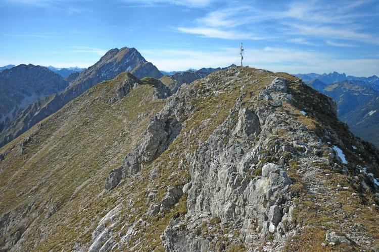
The Kreuzspitze (2,185 m) is the highest mountain in the Bavarian section of the Ammergau Alps.
Map of Kreuzspitze, 82488 Ettaler Forst, Germany
The mountain is located southeast of the Ammer Saddle. The easiest route to the summit is along the normal path from the north through the Hochgrieß Cirque (Hochgrießkar). A more scenic and varied route, however, is over the Kreuzspitzl to the south and then along the scenic ridge (UIAA climbing grade I to II) to the main peak. The mountain also offers a challenging ski tour through the Hochgrieß Cirque.
The surrounding peaks of Frieder, Geierköpfe and Schellschlicht are also popular tour destinations.
References
Kreuzspitze (Ammergau Alps) Wikipedia(Text) CC BY-SA