
Elevation 524 m Population 68 (2006) | Postal code 387 16 Area 3.46 km² | |
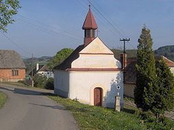 | ||
Krejnice is a village and municipality (obec) in Strakonice District in the South Bohemian Region of the Czech Republic.
Map of 387 16 Krejnice, Czechia
The municipality covers an area of 3.46 square kilometres (1.34 sq mi), and has a population of 68 (as at 3 July 2006).
Krejnice lies approximately 14 kilometres (9 mi) west of Strakonice, 63 km (39 mi) north-west of České Budějovice, and 108 km (67 mi) south-west of Prague.
The first historical mention of the village dates from the year 1045 (Crainice).
References
Krejnice Wikipedia(Text) CC BY-SA