
Country Russia Rural localities 25 Area 725.5 km² | Federal subject Republic of Adygea Urban settlements 0 | |
 | ||
Administrative center selo of Krasnogvardeyskoye Municipally incorporated as | ||
Krasnogvardeysky District (Russian: Красногварде́йский райо́н; Adyghe: Красногвардейскэ къедзыгъо) is an administrative and a municipal district (raion), one of the seven in the Republic of Adygea, Russia. It is located in the northwest of the republic and borders with Ust-Labinsky District of Krasnodar Krai in the north, Shovgenovsky District in the east, Belorechensky District of Krasnodar Krai in the south, and with Krasnodar Reservoir in the west. Its borders with Teuchezhsky District (in the west) and Dinskoy District of Krasnodar Krai (in the northwest) pass through the waters of Krasnodar Reservoir. The area of the district is 725.52 square kilometers (280.12 sq mi). Its administrative center is the rural locality (a selo) of Krasnogvardeyskoye. As of the 2010 Census, the total population of the district was 30,868, with the population of Krasnogvardeyskoye accounting for 30.6% of that number.
Contents
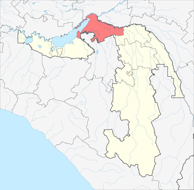
- Map of Krasnogvardeysky District Adygea Russia
- History
- Administrative and municipal status
- Municipal composition
- References
Map of Krasnogvardeysky District, Adygea, Russia
History
The district was established on February 7, 1929. It was transformed into a rural district on February 1, 1963, but this was reversed on January 12, 1965. The district has been dealing with mass illegal immigration of ethnic Kurds in recent years.
Administrative and municipal status
Within the framework of administrative divisions, Krasnogvardeysky District is one of the seven in the Republic of Adygea and has administrative jurisdiction over all of its twenty-five rural localities. As a municipal division, the district is incorporated as Krasnogvardeysky Municipal District. Its twenty-five rural localities are incorporated into seven rural settlements within the municipal district. The selo of Krasnogvardeyskoye serves as the administrative center of both the administrative and municipal district.
Municipal composition
- Beloselskoye Rural Settlement (Белосельское) Administrative center: selo of Beloye other localities of the rural settlement:
- khutor of Bogursukov
- settlement of Mirny
- selo of Novosevastopolskoye
- khutor of Papenkov
- selo of Preobrazhenskoye
- Bolshesidorovskoye Rural Settlement (Большесидоровское) Administrative center: selo of Bolshesidorovskoye other localities of the rural settlement:
- aul of Dzhambechi
- Khatukayskoye Rural Settlement (Хатукайское) Administrative center: aul of Khatukay other localities of the rural settlement:
- settlement of Lesnoy
- settlement of Naberezhny
- settlement of Svobodny
- settlement of Vodny
- Krasnogvardeyskoye Rural Settlement (Красногвардейское) Administrative center: selo of Krasnogvardeyskoye other localities of the rural settlement:
- aul of Adamiy
- khutor of Chumakov
- Sadovoye Rural Settlement (Садовое) Administrative center: selo of Sadovoye other localities of the rural settlement:
- aul of Bzhedugkhabl
- selo of Verkhnenazarovskoye
- Ulyapskoye Rural Settlement (Уляпское) Administrative center: aul of Ulyap other localities of the rural settlement:
- selo of Shturbino
- Yelenovskoye Rural Settlement (Еленовское) Administrative center: selo of Yelenovskoye other localities of the rural settlement:
- khutor of Doguzhiyev
- khutor of Pustoselov
- khutor of Saratovsky