
Type reservoir Primary outflows Oskol River Max. length 125 km (78 mi) Surface elevation 72 m Catchment area 14,700 km² Length 125 km Inflow source Oskol River | Primary inflows Basin countries Ukraine Max. width 4 km (2.5 mi) Area 130 km² Mean depth 4 m Outflow location Oskol River | |
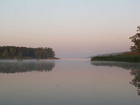 | ||
Krasno-Oskol Reservoir (Ukrainian: Червоноскільське водосховище; Russian: Краснооскольское водохранилище, sometimes translated as Chervonooskil -, Krasnooskol'skoye - or Krasno-Oskol'skoe -) is an artificial lake on Oskol River in Kharkiv Oblast, Ukraine.
Map of Chervono-Oskol Reservoir, Ukraine
The reservoir was opened in year 1958. Its area is 130 km², maximal length 125 km, maximal width 4 km, average depth is 4 m and about the volume 474 hm³. The purpose of the reservoir is to regulate flooding, serve as source for electricity and to help fishing industry.
References
Krasno-Oskol Reservoir Wikipedia(Text) CC BY-SA