
Population 3,916 (2011 census) LGA(s) City of Newcastle Kotara Adamstown Postal code 2289 | Postcode(s) 2289 State electorate(s) Charlestown Area 240 ha Parish Newcastle | |
 | ||
Location 9 km (6 mi) WSW of Newcastle
4 km (2 mi) N of Charlestown Federal divisions Division of Charlton, Division of Newcastle | ||
Kotara /ˌkəˈtɑːrə/ is a suburb of Newcastle, New South Wales, Australia, located 9 kilometres (6 mi) from Newcastle's central business district. It is part of the City of Newcastle local government area.
Contents
Map of Kotara NSW 2289, Australia
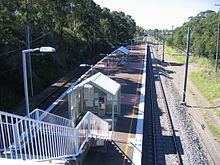
The Australasia Coal Company operated a mine near Kotara, in the valley below the present-day northern entrance to Tickhole Tunnel. A private railway connected the screens with the Government line near the present-day triangle junctions north of Broadmeadow. Surveying for the line commenced in 1875 and the line was completed in April 1877. However, only a total of 9,052 tons was ever produced and the company went into liquidation in June 1879.
Commercial area
Westfield Kotara, formerly known as Garden City and "Gardo" and prior to that known as Kotara Fair, is a major shopping centre which features a department store, two discount department stores, two supermarkets and a variety of other clothing, toy, homeware and newsagency stores and many cafes and a foodcourt.
Education
Kotara is home to Kotara South Public School on Rodway Parade and the local Catholic School St James Primary School, located on Vista Parade.