
Country United States FIPS code 29-39440 Elevation 297 m Zip code 65692 Local time Friday 10:30 AM | Time zone Central (CST) (UTC-6) GNIS feature ID 0720691 Area 47 ha Population 217 (2013) Area code 417 | |
 | ||
Weather 11°C, Wind S at 13 km/h, 80% Humidity | ||
Koshkonong is a city in Oregon County, Missouri, United States. The population was 212 at the 2010 census.
Contents
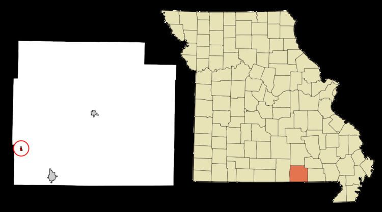
Map of Koshkonong, MO 65692, USA
History
Koshkonong was laid out 1882, taking its name from Lake Koshkonong, in Wisconsin. A post office called Koshkonong has been in operation since 1893.
Geography
Koshkonong is located at 36°35′43″N 91°38′43″W (36.595356, -91.645360).
According to the United States Census Bureau, the city has a total area of 0.18 square miles (0.47 km2), all land.
2010 census
As of the census of 2010, there were 212 people, 85 households, and 54 families residing in the city. The population density was 1,177.8 inhabitants per square mile (454.8/km2). There were 102 housing units at an average density of 566.7 per square mile (218.8/km2). The racial makeup of the city was 91.51% White, 0.47% Black or African American, 1.42% Native American, 0.47% from other races, and 6.13% from two or more races. Hispanic or Latino of any race were 1.42% of the population.
There were 85 households of which 32.9% had children under the age of 18 living with them, 42.4% were married couples living together, 10.6% had a female householder with no husband present, 10.6% had a male householder with no wife present, and 36.5% were non-families. 28.2% of all households were made up of individuals and 12.9% had someone living alone who was 65 years of age or older. The average household size was 2.49 and the average family size was 2.98.
The median age in the city was 39 years. 23.1% of residents were under the age of 18; 13.2% were between the ages of 18 and 24; 22.2% were from 25 to 44; 29.2% were from 45 to 64; and 12.3% were 65 years of age or older. The gender makeup of the city was 46.7% male and 53.3% female.
2000 census
As of the census of 2000, there were 205 people, 91 households, and 53 families residing in the town. The population density was 1,087.6 people per square mile (416.6/km²). There were 108 housing units at an average density of 573.0 per square mile (219.5/km²). The racial makeup of the town was 94.63% White, 1.95% Native American, 1.46% Asian, and 1.95% from two or more races. Hispanic or Latino of any race were 1.46% of the population.
There were 91 households out of which 33.0% had children under the age of 18 living with them, 46.2% were married couples living together, 11.0% had a female householder with no husband present, and 40.7% were non-families. 36.3% of all households were made up of individuals and 20.9% had someone living alone who was 65 years of age or older. The average household size was 2.25 and the average family size was 2.93.
In the town the population was spread out with 27.8% under the age of 18, 5.9% from 18 to 24, 23.4% from 25 to 44, 25.4% from 45 to 64, and 17.6% who were 65 years of age or older. The median age was 39 years. For every 100 females there were 79.8 males. For every 100 females age 18 and over, there were 72.1 males.
The median income for a household in the town was $15,341, and the median income for a family was $16,250. Males had a median income of $21,250 versus $14,750 for females. The per capita income for the town was $7,893. About 41.8% of families and 44.6% of the population were below the poverty line, including 44.1% of those under the age of 18 and 45.2% of those 65 or over.