
Elevation 235 m | Region Ústí nad Labem Postal code 434 01 Area 6.38 km² | |
 | ||
Website | ||
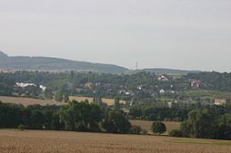
Korozluky (German Kolosoruk) is a village and municipality (obec) in Most District in the Ústí nad Labem Region of the Czech Republic.
Map of 434 01 Korozluky, Czechia
The municipality covers an area of 6.38 square kilometres (2.46 sq mi), and has a population of 158 (as at 28 August 2006).
Korozluky lies approximately 7 kilometres (4 mi) south-east of Most, 31 km (19 mi) south-west of Ústí nad Labem, and 66 km (41 mi) north-west of Prague.
References
Korozluky Wikipedia(Text) CC BY-SA