Neha Patil (Editor)

Koke'e State Park

Updated on
Edit
Like
Comment
Share on FacebookTweet on TwitterShare on LinkedInShare on Reddit
Location
  
Kauaʻi, United States

Phone
  
+1 808-335-8405

Address
  
Hanapepe, HI 96716, USA

Koke'e State Park

Governing body
  
Hawaii Department of Land and Natural Resources

Management
  
Hawai'i Department of Land and Natural Resources

Visit of waimea canyon and koke e state park kauai


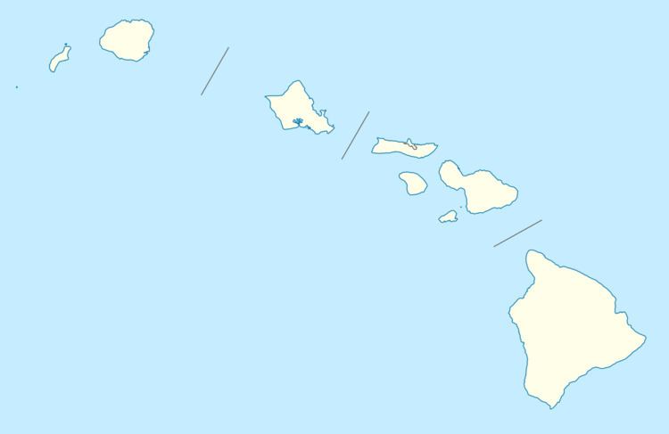
Kōkeʻe State Park is located in northwestern Kauaʻi in the Hawaiian Islands. It includes the Kōkeʻe Museum at the 15 mi (24 km) marker on State Road 550, which focuses on the weather, vegetation, and bird life; a lodge which serves food and sells gifts; cabins for rent; and hiking trails. The park is just north of Waimea Canyon State Park at 22°7′49″N 159°39′32″W and includes 4,345 acres (17.58 km2) of mountainous terrain.

Contents

The main attractions of Kōkeʻe State Park trails are the native vegetation, native forest birds, and the scenic cliffside views. Situated on a plateau between 3,200 and 4,200 ft (980 and 1,280 m), much of Kōkeʻe is a montane (infrequent frost) mesic forest (50 to 100 in or 1,300 to 2,500 mm annual rainfall with moist soil conditions) dominated by koa (Acacia koa) and ʻōhiʻa lehua (Metrosideros polymorpha) trees. The park receives around 70 inches (1,800 mm) of rain per year, mostly from October to May.

At the end of the state road is a lookout onto the Kalalau Valley, once home to thousands of native Hawaiians. The valley was the backdrop for Jack London's short story Koʻolau the Leper.

In October it is the home of a festival honoring Queen Emma of Hawaii.

Hiking Trails

  • Alakaʻi Swamp Trail, length: 3.5 mi (5.6 km). Trail through native wet forest to the rim of Wainiha Pali with sweeping view of the north shore. Great birdwatching trail. Trail is often wet, slippery and muddy. The majority of this trail is a plank boardwalk covered with chicken wire to provide traction.
  • Awaʻawapuhi Trail, length: 3.25 mi (5.23 km). Trail with mesic and dryland native plants. Spectacular view into steep-sided Nuʻalolo and Awaʻawapuhi Valleys. Return climb of 1,620 ft (490 m).
  • Berry Flat Trail, length: 0.6 mi (0.97 km). This trail traverses a mix of planted alien and native forest types, including Coast Redwood (Sequoia sempervirens) and Sugi (Cryptomeria japonica) groves and disturbed koa/ʻōhiʻa forest.
  • Black Pipe Trail, length: 0.5 mi (0.80 km). This trail is an alternate access to the Canyon Trail. Native hibiscus and iliau (Wilkesia gymnoxiphium) can be seen along the trail.
  • Canyon Trail, length: 1.8 mi (2.9 km). A popular scenic trail with great views of Waimea and Poʻomau Canyons. The trail follows the rim of Waimea Canyon and crosses Kōkeʻe Stream.
  • Cliff Trail, length: 0.1 mi (0.16 km). A spur trail leading to a viewpoint of Waimea Canyon. Feral goats are often seen on the canyon walls.
  • Ditch Trail, length: 1.7 mi (2.7 km). A trail developed to construct and maintain the Kōkeʻe Ditch. Vistas of surrounding forest and Poʻomau Stream.
  • Faye Trail, length: 0.1 mi (0.16 km). A short trail that accesses other trails in the Halemanu area.
  • Halemanu-Kōkeʻe Trail, length: 1.2 mi (1.9 km). This trail wanders through somewhat disturbed koa/ʻōhiʻa forest. Recovery from Hurricane Iwa and transition to koa forest from drier conditions is evident.
  • Iliau Nature Loop, length: 0.25 mi (0.40 km). Easy roadside nature trail through dry shrubland with plants identified. Sweeping views of Waimea Canyon and Waiʻalae Canyon.
  • Kaluapuhi Trail, length: 1.6 mi (2.6 km). Disturbed ʻōhiʻa montane mesic forest with some intact forest areas. Good birdwatching trail.
  • Kukui Trail, Length: 2.5 mi (4.0 km). Scenic, but steep trail into Waimea Canyon. Elevation drop of 2,000 ft (610 m).
  • Kumuwela Trail, length: 1 mi (1.6 km). Mosaic of ʻōhiʻa and koa/ʻōhiʻa montane mesic forests with alien weed problems and hurricane damage. A good birdwatching trail.
  • Nature Trail, length: 0.1 mi (0.16 km). Good starter trail to learn about native forest vegetation.
  • Nuʻalolo Trail, length: 3.75 mi (6.04 km). Trail through koa/ʻōhiʻa montane mesic forests and an ʻaʻaliʻi (Dodonaea viscosa) lowland dry shrubland with a great view of Nuʻalolo Valley. Return climb of 1,570 ft (480 m).
  • Pihea Trail, length: 3.7 mi (6.0 km). Scenic nature trail along the rim of Kalalau Valley, traversing ʻōhiʻa montane wet forest. Great birdwatching trail.
  • Puʻu ka ʻOhelo Trail, length: 0.5 miles (0.80 km). Along this trail are good examples of the impact that invasive alien weeds can have on native forest vegetation.
  • Waininiua Trail, length: 0.6 mi (0.97 km). A good trail to see a relatively intact koa/ʻōhiʻa montane mesic forest.
  • Water Tank Trail, length: 1 mi (1.6 km). This trail provide a good example of native koa/ʻōhiʻa forest.
  • References

    Koke'e State Park Wikipedia