
Elevation 523 m | Postal code 580 01 Area 7.99 km² | |
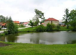 | ||
Kojetín is a village and municipality (obec) in Havlíčkův Brod District in the Vysočina Region of the Czech Republic.
Map of 580 01 Kojet%C3%ADn, Czechia
The municipality covers an area of 7.99 square kilometres (3.08 sq mi), and has a population of 165 (as at 3 July 2006).
Kojetín lies approximately 8 kilometres (5 mi) north-east of Havlíčkův Brod, 30 km (19 mi) north of Jihlava, and 101 km (63 mi) south-east of Prague.
References
Kojetín (Havlíčkův Brod District) Wikipedia(Text) CC BY-SA