
Area 1,313 km² Population 4,067 (2013) | Website www.knoxcountymo.org Founded 1745 | |
 | ||
Rivers Fabius River, Sand Hill Branch, Long Branch | ||
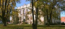
160 acres knox county missouri
Knox County is a county located in the northeast portion of the U.S. state of Missouri. As of the 2010 census, the population was 4,131, making it the third-least populous county in Missouri. Its county seat is Edina. The county was organized February 14, 1845 and named for U.S. Secretary of War General Henry Knox.
Contents
- 160 acres knox county missouri
- Map of Knox County MO USA
- Geography
- Adjacent counties
- Major highways
- Demographics
- Public schools
- Local
- State
- Federal
- Missouri Presidential Preference Primary 2008
- Cities
- Villages
- Census designated place
- Other unincorporated place
- Townships
- Notable people
- References
Map of Knox County, MO, USA
Geography
According to the U.S. Census Bureau, the county has a total area of 507 square miles (1,310 km2), of which 504 square miles (1,310 km2) is land and 2.8 square miles (7.3 km2) (0.6%) is water.
Adjacent counties
Major highways
Demographics
As of the census of 2010, there are 4,131 people in the county, organized into 1,791 households and 1,217 families. The population density is 9 people per square mile (3/km²). There are 2,317 housing units at an average density of 5 per square mile (2/km²). The racial makeup of the county is 98.51% White, 0.09% Black or African American, 0.09% Asian, 0.02% Native American, 0.16% from other races, and 1.12% from two or more races. Approximately 0.60% of the population were Hispanic or Latino of any race.
There are 1,791 households out of which 27.90% have children under the age of 18 living with them, 57.50% are married couples living together, 6.90% have a female householder with no husband present, and 32.00% are non-families. 29.30% of all households are made up of individuals and 16.00% have someone living alone who is 65 years of age or older. The average household size is 2.38 and the average family size is 2.93.
24.90% of the county's population is under the age of 18, 6.20% from 18 to 24, 23.70% from 25 to 44, 23.90% from 45 to 64, and 21.20% who are 65 years of age or older. The median age is 42 years. For every 100 females there are 92.9 males. For every 100 females age 18 and over, there are 91.6 males.
The median income for a household in the county is $27,124, and the median income for a family is $31,741. Males have a median income of $22,636 versus $18,902 for females. The per capita income for the county is $13,075. 18.00% of the population and 12.90% of families are below the poverty line. Out of the total population, 24.10% of those under the age of 18 and 16.50% of those 65 and older are living below the poverty line.
The TFR for Knox County in 2004 was relatively high at 2.64, despite the population being 98% white. [1]
Public schools
Local
The Democratic Party mostly controls politics at the local level in Knox County. Democrats hold all but five of the elected positions in the county.
State
All of Knox County is included in Missouri’s 4th District in the Missouri House of Representatives and is represented by Craig Redmon (R-Canton).
All of Knox County is a part of Missouri’s 18th District in the Missouri Senate and is currently represented by Brian Munzlinger (R-Williamstown).
Federal
All of Knox County is included in Missouri’s 6th Congressional District and is currently represented by Sam Graves (R-Tarkio) in the U.S. House of Representatives.
Missouri Presidential Preference Primary (2008)
Cities
Villages
Census-designated place
Other unincorporated place
Townships
Knox County is divided into 13 townships: