
Local time Thursday 9:44 AM | ||
 | ||
Weather 7°C, Wind SW at 14 km/h, 93% Humidity | ||
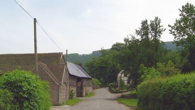
Knill is a village and civil parish in Herefordshire, England.
Map of Knill, Presteigne, UK
Recorded in the Domesday Book (1086) as Chenille (from the Old English meaning 'Place by the hillock') the little village of Knill sits just inside the Herefordshire side of the border with Wales, 4.5 km (2.8 mi) south west of Presteigne and very much in 'The Marches' as these borderlands are known. The ancient boundary between Mercia and the Welsh, Offa's Dyke, runs along the ridge above the village with the modern border running along the 'Hidden Valley' floor.
The population of the village in the 1861 census was 84 and this has now declined to figures in the 20s.
The parish church of St Michael dates from the 12th century and is a Grade II* listed building. Inside are the hatchments of the Walsham family, who formerly lived at Knill Court, a large country house which was destroyed by a fire in 1943.
Knill is one of two Thankful Villages in Herefordshire - those rare places that suffered no fatalities during the Great War of 1914 to 1918. There is thus no war memorial in the village but in the parish church there is a carved stone plaque on the wall, which greets visitors with the inscription:
TO THE GLORY OF GOD
AND IN THANKSGIVING TO HIM FOR
THE VICTORY GRANTED TO US IN THE
GREAT WAR OF 1914-1918
AND FOR HIS MERCIES IN BRINGING
SAFELY HOME THE MEN OF THIS PARISH
WHO SERVED THEIR COUNTRY OVERSEAS
TO THE GLORY OF GOD
AND IN THANKSGIVING TO HIM FOR
THE VICTORY GRANTED TO US IN THE
GREAT WAR OF 1914-1918
AND FOR HIS MERCIES IN BRINGING
SAFELY HOME THE MEN OF THIS PARISH
WHO SERVED THEIR COUNTRY OVERSEAS