
District Uherské Hradiště Elevation 180 m Local time Thursday 2:27 PM | Postal code 687 12 Area 9.29 km² | |
 | ||
Weather 14°C, Wind NW at 18 km/h, 31% Humidity | ||
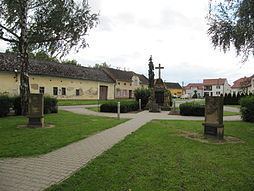
Kněžpole is a village and municipality (obec) in Uherské Hradiště District in the Zlín Region of the Czech Republic.
Map of 687 12 Kn%C4%9B%C5%BEpole, Czechia
The municipality covers an area of 9.29 square kilometres (3.59 sq mi), and has a population of 1,099 (as at 3 July 2006).
Kněžpole lies approximately 6 kilometres (4 mi) north-east of Uherské Hradiště, 19 km (12 mi) south-west of Zlín, and 249 km (155 mi) south-east of Prague.
References
Kněžpole Wikipedia(Text) CC BY-SA