
Local time Thursday 7:00 AM | ||
 | ||
Weather 3°C, Wind S at 8 km/h, 77% Humidity | ||
Klokkarstua is a village in the county of Buskerud, Norway. It is located on the southern part of Hurumlandet, the peninsula between the Oslofjord and Drammensfjord.
Map of 3490 Klokkarstua, Norway
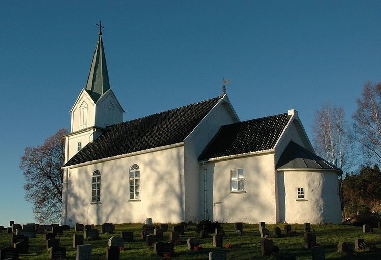
Highway 289 (Rv289) runs through the village and meanders west down to the Drammensfjord, where the ferry goes on to Svelvik. This is the location for a production plant of Rottefella ski bindings. It also has a sports complex. Klokkarstua is the site of Hurum Town Hall and Hurum Church. Its population (2005) is about 700.
Hurum Church (Hurum kirke) is a medieval era stone church dating from 1150. The pulpit was a gift from the wife of naval hero, Ivar Huitfeldt. This is the location of the Huitfeldt family tomb which dates from 1750.
References
Klokkarstua Wikipedia(Text) CC BY-SA