
Area 645.9 km² Local time Thursday 6:45 AM | Region ChūgokuSan'yō Population 20,106 (31 Jan 2012) | |
 | ||
Time zone Japan Standard Time (UTC+9) City hall address 1234 Arita, Kitahiroshima-machi, Yamagata-gun, Hiroshima-ken731-1595 Weather 1°C, Wind NW at 6 km/h, 95% Humidity Points of interest Yutopiasaioto Ski Area, Enryuji, Ōdomari Dam | ||
Kitahiroshima (北広島町, Kitahiroshima-chō) is a town in Yamagata District, Hiroshima Prefecture, Japan.
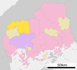
Map of Kitahiroshima, Yamagata District, Hiroshima Prefecture, Japan
Kitahiroshima was formed on February 1, 2005 from the merger of the towns of Chiyoda, Geihoku, Ōasa and Toyohira, all from Yamagata District.
As of January 31, 2012, population data, the town has an estimated population of 20,106, with 8,328 households, and a population density of 31.13 persons per km². The total area is 645.86 km².
References
Kitahiroshima, Hiroshima Wikipedia(Text) CC BY-SA