
Founded 1955 Lowest elevation 60 m (200 ft) Population 119,474 (1 Oct 2015) | Highest elevation 895 m (2,936 ft) Area 94.92 km² | |
 | ||
Website www.city.kyoto.lg.jp/kita/ Colleges and Universities Ritsumeikan University, Kyoto Sangyo University, Bukkyo University, Ōtani University, Otani University Junior Co Points of interest Kinkaku‑ji, Daitoku‑ji, Kamo Shrine, Tōji‑in, Daisen‑in | ||
Kita (北区, Kita-ku) is one of the eleven wards in the city of Kyoto, in Kyoto Prefecture, Japan. Its name means "North Ward." As of 2016, the ward has an estimated population of 119,074 people.
Contents
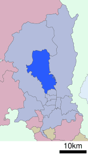
- Map of Kita Ward Kyoto Kyoto Prefecture Japan
- Universities
- Primary and secondary schools
- Culture
- Temples and Landmarks
- References
Map of Kita Ward, Kyoto, Kyoto Prefecture, Japan
Universities
Primary and secondary schools
The community previously had a North Korean school, Kyoto Korean No. 3 Elementary School (京都朝鮮第三初級学校).
Culture
Temples and Landmarks
References
Kita-ku, Kyoto Wikipedia(Text) CC BY-SA