
Population 840 (2011 Census) Civil parish Kirkland Local time Tuesday 6:22 PM District Wyre | OS grid reference SD479438 Sovereign state United Kingdom Dialling code 01995 | |
 | ||
Weather 10°C, Wind W at 24 km/h, 77% Humidity | ||
Kirkland is a civil parish, located on the banks of the River Wyre, midway between Preston and Lancaster, in the English county of Lancashire. It is also the historic name of what is now the village of Churchtown, within the parish. It is part of the Wyre district.
Map of Kirkland, UK
Kirkland has a long history centred on its Grade I listed building, St Helen's, the parish church of Garstang St Helen (or Churchtown) and once known as the Cathedral of the Fylde. The church features:
There are significant pointers such as a circular churchyard with several yew trees to its original use as a Druid temple. It was believed by some that the area may have been the site where Christian missionaries from Ireland first set foot in Lancashire at the end of the navigational portion of the River Wyre which flows to the Irish Sea some 14 miles away. St Helen's is one of only two Grade I listed buildings in the Borough of Wyre.
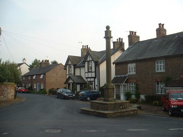
Although known as "The Cross", the village has an 18th-century Grade II listed dialpost with a sundial at its head, at the top of Church Street. There are two pubs: the Punchbowl and the Horns Inn.