
OS grid reference SP452771 Post town COVENTRY Dialling code 024 | Sovereign state United Kingdom Local time Tuesday 8:13 AM | |
 | ||
Weather 8°C, Wind SW at 8 km/h, 100% Humidity | ||
King's Newnham (otherwise known as Newnham Regis) is a village and civil parish located just under 2.5 miles (4 km) west of the town of Rugby and 4.5 miles (7 km) east of Coventry. For population details see Church Lawford. It is within the borough of Rugby and Warwickshire county council.
Contents
Map of King's Newnham, Rugby, UK
History
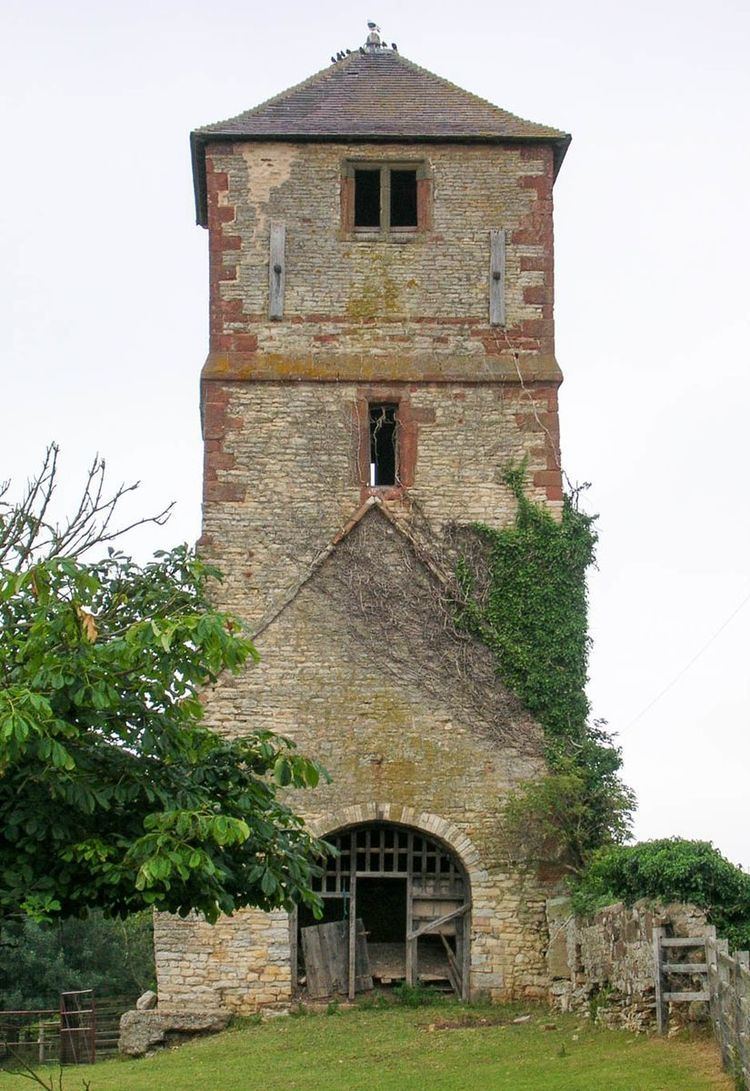
It lost most of its population as a result of enclosures of the former Royal Manor. Its parish church, St Laurence's, was built in the 12th century, and partially demolished 1795–97, leaving its mostly 16th-century tower and it disused. The five other listed buildings of the parish are very close relative to the distant northern parish border: Farm Building near Newnham Hall, The Laurels, Highfield House, Newnham Hall and Manor Farmhouse.
Today
For ecclesiastical purposes King's Newnham is joined with nearby Church Lawford from which it is separated by the Warwickshire Avon to the south. The parish council meets and shares the community facilities of Church Lawford community hall.