
Distance to Malé 228.05 km (141.70 mi) | Administrative atoll Thaa Atoll Time zone MST (UTC+05:00) | |
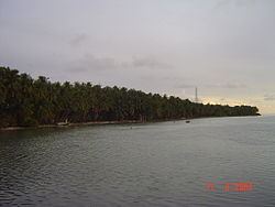 | ||
Kinbidhoo (Dhivehi: ކިނބިދޫ) is one of the inhabited islands of Thaa Atoll. In the order of the inhabited islands, Kinbidhoo is the 12th island and the island code is N-12.
Contents
Map of Kinbidhoo, Maldives
Kinbidhoo is situated closest to Veymadoo, the capital of Tha Atoll.
2004 tsunami
Kinbidhoo was struck by the tsunami that followed the Indian Ocean earthquake on December 26, 2004, which swept across the western coast of Sumatra and the whole island flooded completely, destroying some houses and farms, although there were no casualties.
Archaeology
There were important Buddhist ruins in an area of this island. The islanders call this place Veyru.The most conspicuous was a large Stupa whose stonse had been removed and looked like a very steep small hill. Muhammad Ismāīl Dīdī, led a Maldivian expedition to this island in order to explore the Buddhist ruins in the 1960s. Some excavations were conducted and a report on the Buddhist remains of Kimbidu Island was published.
Unfortunately the Buddhist site was not protected after excavation and has been heavily vandalized in recent times. The steep hill that marked the location of the ancient Stupa has been almost flattened out. That place is facing erosion.