
FIPS code 55-39650 Elevation 223 m Local time Monday 7:59 PM | Time zone Central (CST) (UTC-6) GNIS feature ID 1567486 Population 6,641 (2013) Area code Area code 920 | |
 | ||
Weather -7°C, Wind NE at 16 km/h, 67% Humidity Area 6.268 km² (5.853 km² Land / 41 ha Water) | ||
Kimberly is a village in Outagamie County, Wisconsin, United States. The population was 6,468 at the 2010 census. The village is east of Appleton.
Contents
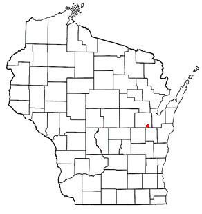
- Map of Kimberly WI USA
- History
- Geography
- 2010 census
- 2000 census
- Landmarks and businesses
- Education
- References
Map of Kimberly, WI, USA
History
Kimberly was originally known as The Cedars (after the Treaty of the Cedars). In 1889 it was renamed after John A. Kimberly (1838–1928), one of the co-founders of what is now the Kimberly-Clark Corporation.
Geography
Kimberly is located at 44°16′N 88°20′W (44.2684, -88.3375).
According to the United States Census Bureau, the village has a total area of 2.42 square miles (6.27 km2), of which, 2.26 square miles (5.85 km2) of it is land and 0.16 square miles (0.41 km2) is water.
2010 census
As of the census of 2010, there were 6,468 people, 2,739 households, and 1,760 families residing in the village. The population density was 2,861.9 inhabitants per square mile (1,105.0/km2). There were 2,871 housing units at an average density of 1,270.4 per square mile (490.5/km2). The racial makeup of the village was 94.0% White, 0.8% African American, 0.9% Native American, 2.1% Asian, 0.8% from other races, and 1.4% from two or more races. Hispanic or Latino of any race were 2.3% of the population.
There were 2,739 households of which 31.4% had children under the age of 18 living with them, 49.8% were married couples living together, 8.9% had a female householder with no husband present, 5.5% had a male householder with no wife present, and 35.7% were non-families. 30.3% of all households were made up of individuals and 13.3% had someone living alone who was 65 years of age or older. The average household size was 2.35 and the average family size was 2.92.
The median age in the village was 38.1 years. 24.4% of residents were under the age of 18; 7% were between the ages of 18 and 24; 27.6% were from 25 to 44; 24.4% were from 45 to 64; and 16.4% were 65 years of age or older. The gender makeup of the village was 48.6% male and 51.4% female.
2000 census
As of the census of 2000, there were 6,146 people, 2,507 households, and 1,677 families residing in the village. The population density was 3,265.9 per square mile (1,261.0/km2). There were 2,593 housing units at an average density of 1,377.9 per square mile (532.0/km2). The racial makeup of the village was 97.54% White, 0.26% African American, 0.72% Native American, 0.83% Asian, 0.16% from other races, and 0.49% from two or more races. Hispanic or Latino of any race were 0.75% of the population.
There were 2,507 households out of which 32.2% had children under the age of 18 living with them, 56.2% were married couples living together, 7.8% had a female householder with no husband present, and 33.1% were non-families. 28.2% of all households were made up of individuals and 11.8% had someone living alone who was 65 years of age or older. The average household size was 2.45 and the average family size was 3.04.
In the village, the population was spread out with 25.8% under the age of 18, 7.5% from 18 to 24, 33.0% from 25 to 44, 18.7% from 45 to 64, and 15.0% who were 65 years of age or older. The median age was 35 years. For every 100 females there were 96.5 males. For every 100 females age 18 and over, there were 93.4 males.
The median income for a household in the village was $46,370, and the median income for a family was $54,692. Males had a median income of $40,213 versus $26,581 for females. The per capita income for the village was $20,933. About 1.5% of families and 3.1% of the population were below the poverty line, including 2.7% of those under age 18 and 6.6% of those age 65 or over.
Landmarks and businesses
Kimberly Mill The Kimberly Mill is located on the Fox River. It was built in 1889 by the Kimberly Clark Corporation to make newsprint. Beginning in the 1920s, it started making coated paper. In 1976 it was sold to Repap Corporation. It was in turn sold to Consolidated Papers (1997), Stora Enso (2000), and NewPage Corp. (2007). On July 30, 2008, NewPage announced its plans to close the plant in August 2008 and sever employment by September 30, 2008.
The Kimberly Mill continued to produce fine paper, magazine paper and specialty paper, until the shut down date. New Page has recently shown interest in selling the mill, and it was announced on June 7, 2011 that NewPage has signed a deal to sell the property to AIM Demolition (a metal recycling company) out of Montreal.
Education
Kimberly is served by the Kimberly Area School District, which also draws students from Kimberly, Combined Locks, and parts of Buchanan and Harrison (Darboy).