
Country United States County Kimball FIPS code 31-25475 Elevation 1,437 m Zip code 69145 Local time Monday 6:37 PM | Time zone Mountain (MST) (UTC-7) GNIS feature ID 0830504 Area 5.36 km² Population 2,425 (2013) Area code 308 | |
 | ||
Weather 8°C, Wind E at 3 km/h, 59% Humidity | ||
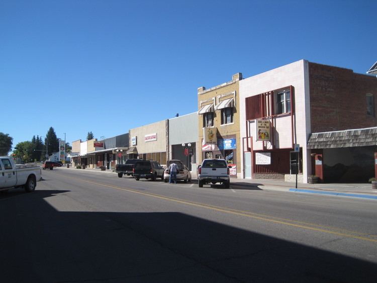
Kimball is a city and county seat of Kimball County, Nebraska, United States. The population was 2,496 at the 2010 census.
Contents
- Map of Kimball NE 69145 USA
- History
- Geography
- 2010 census
- 2000 census
- Media
- Parks and Recreation
- Transportation
- Notable people
- References
Map of Kimball, NE 69145, USA
History
Kimball was originally called Antelopeville, and under the latter name was established in about 1870 when the Union Pacific Railroad was extended to that point. It was renamed in 1885 in honor of Thomas Kimball, a railroad official. Kimball was incorporated in 1888.
Geography
Kimball is located at 41°14′1″N 103°39′34″W (41.233693, -103.659463), in the southwestern Panhandle. According to the United States Census Bureau, the city has a total area of 2.07 square miles (5.36 km2), all of it land.
Kimball declares itself as the "The High Point of Nebraska!", as the highest point in the state is about 33 miles (53 km) from the city. Panorama Point, 5,424 feet (1,653 m) above sea level, is located at N 41 degrees 00.461 minutes, W 104 degrees 01.883 minutes. It is marked by a small monument. Kimball itself is not the Nebraska town with the highest elevation: that status belongs to Harrison, at 4,876 feet (1,486 m).
2010 census
As of the census of 2010, there were 2,496 people, 1,110 households, and 651 families residing in the city. The population density was 1,205.8 inhabitants per square mile (465.6/km2). There were 1,278 housing units at an average density of 617.4 per square mile (238.4/km2). The racial makeup of the city was 93.8% White, 0.2% African American, 1.5% Native American, 0.4% Asian, 0.1% Pacific Islander, 1.6% from other races, and 2.5% from two or more races. Hispanic or Latino of any race were 7.1% of the population.
There were 1,110 households of which 26.5% had children under the age of 18 living with them, 45.9% were married couples living together, 8.6% had a female householder with no husband present, 4.1% had a male householder with no wife present, and 41.4% were non-families. 36.8% of all households were made up of individuals and 18.8% had someone living alone who was 65 years of age or older. The average household size was 2.21 and the average family size was 2.88.
The median age in the city was 44.8 years. 23.2% of residents were under the age of 18; 7.1% were between the ages of 18 and 24; 20% were from 25 to 44; 26.2% were from 45 to 64; and 23.6% were 65 years of age or older. The gender makeup of the city was 48.8% male and 51.2% female.
2000 census
As of the census of 2000, there were 2,559 people, 1,110 households, and 700 families residing in the city. The population density was 1,665.8 people per square mile (641.6/km²). There were 1,210 housing units at an average density of 787.6 per square mile (303.4/km²). The racial makeup of the city was 96.25% White, 0.35% African American, 1.06% Native American, 0.16% Asian, 0.39% from other races, and 1.80% from two or more races. Hispanic or Latino of any race were 3.52% of the population.
There were 1,110 households out of which 25.4% had children under the age of 18 living with them, 51.8% were married couples living together, 8.0% had a female householder with no husband present, and 36.9% were non-families. 33.7% of all households were made up of individuals and 18.0% had someone living alone who was 65 years of age or older. The average household size was 2.25 and the average family size was 2.84.
In the city, the population was spread out with 24.1% under the age of 18, 6.1% from 18 to 24, 23.1% from 25 to 44, 23.3% from 45 to 64, and 23.4% who were 65 years of age or older. The median age was 43 years. For every 100 females there were 90.0 males. For every 100 females age 18 and over, there were 86.4 males.
As of 2000 the median income for a household in the city was $29,984, and the median income for a family was $37,273. Males had a median income of $29,222 versus $18,198 for females. The per capita income for the city was $18,762. About 7.9% of families and 10.2% of the population were below the poverty line, including 12.6% of those under age 18 and 6.6% of those age 65 or over.
Media
The weekly Western Nebraska Observer, serving Kimball and Banner counties, is published in Kimball.
Parks and Recreation
Kimball has two parks: City Park and Gotte Park. The latter includes the municipal swimming pool. The 18-hole Four Winds Golf Course is also operated by the city parks and recreation department.
Transportation
Interstate 80 runs east–west just south of Kimball; there is an exit for the city. U.S. Highway 30 runs east–west through the city. Nebraska Highway 71 runs north–south through Kimball.
The Kimball Airport Authority operates an airport 3 miles (5 km) south of the city.
The Kimball County Shuttle provides public transportation. The shuttle is equipped for wheelchair accessibility.