
Population 353 (2011 census) Kilmore East Clonbinane | Postcode(s) 3764 Postal code 3764 | |
 | ||
Location 90 km (56 mi) from Melbourne4 km (2 mi) from Kilmore | ||
Kilmore East is a locality in the Australian state of Victoria, 90 kilometres north of Melbourne. At the 2011 census, Kilmore East had a population of 353.
Map of Kilmore East VIC 3764, Australia
Kilmore East railway and telegraph station was established in 1872 to serve Kilmore.
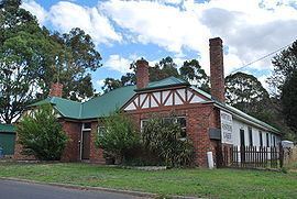
The Post Office at Kilmore East opened on 1 September 1872 as Gavan Duffy, named after Sir Charles Gavan Duffy the Premier of Victoria until June of that year. It was renamed Kilmore East two months later and closed in 1976. Gavan Street and Duffy Street are reminders of the original township name.
In 1976, a bluestone quarry was developed 3 km to the north of the station.
A hilltop above Saunders Road was identified as the starting point of a major bushfire on 7 February 2009 that devastated many localities to the south-east including Wandong and Kinglake.