
Established 1849 Kilkenny Croydon Park Postal code 5009 | Postcode(s) 5009 Founded 1849 Lga City of Charles Sturt | |
 | ||
Population 1,551 (2006 census)
1,392 (2001 Census) Location 7.5 km (5 mi) NW of Adelaide city centre State electorate(s) Croydon (2012) & Enfield (2012) Federal division Division of Port Adelaide (2012) | ||
Kilkenny is an inner north-western suburb of Adelaide, South Australia. It is located in the City of Charles Sturt.
Contents
- Map of Kilkenny SA 5009 Australia
- History
- Geography
- Demographics
- Local government
- State and federal
- Community
- Schools
- Shopping and dining
- Parks
- Roads
- Public transport
- Trains
- Buses
- References
Map of Kilkenny SA 5009, Australia
History
The area incorporating the current suburb of Kilkenny was subdivided in 1849 as the Township of Kilkenny.
Geography
Kilkenny straddles Torrens Road where it joins with Regency Road. Kilkenny Road and David Terrace forms its western boundary.
Demographics
The 2006 Census by the Australian Bureau of Statistics counted 1,551 persons in Kilkenny on census night. Of these, 48.0% were male and 52.0% were female.
The majority of residents (56.9%) are of Australian birth, with other common census responses being Italy (5.0%), Vietnam (4.6%), England (3.4%) and Greece (2.4%).
The age distribution of Kilkenny residents is similar to that of the greater Australian population. 71.4% of residents were over 25 years in 2006, compared to the Australian average of 66.5%; and 28.6% were younger than 25 years, compared to the Australian average of 33.5%.
Local government
Kilkenny is part of Hindmarsh Ward in the City of Charles Sturt local government area, with representative councillors Paul Alexandrides and Alice Campbell.
State and federal
Kilkenny lies in the state electoral districts of Croydon and Enfield and the federal electoral division of Port Adelaide. The suburb is represented in the South Australian House of Assembly by Michael Atkinson (Croydon) and John Rau (Enfield) and federally by Mark Butler.
Community
The local newspaper is the Weekly Times Messenger. Other regional and national newspapers such as The Advertiser and The Australian are also available.
Schools
Challa Gardens Primary School is located on Humphries Terrace.
Shopping and dining
Centro Arndale is located on Torrens Road in the north of the suburb.
Parks
The main park in the suburb is Alton Reserve on Reynell Street. McInerny Reserve, in West Croydon, is accessible from Pinda and Mundulla streets.
Roads
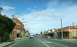
Kilkenny is serviced by Regency Road and Torrens Road, the latter of which connects the suburb to Adelaide city centre.
Public transport
Kilkenny is serviced by public transport run by the Adelaide Metro.
Trains
The Grange and Outer Harbour railway lines pass through the suburb. The closest station is Kilkenny.
Buses
The suburb is serviced by bus routes run by the Adelaide Metro.