
Discharge 21.6 m³/s | Basin area 996 km² | |
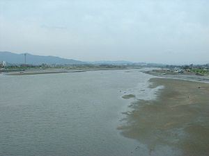 | ||
The Kikuchi River (菊池川, Kikuchi-gawa) flows through the northern part of Kumamoto Prefecture, Kyūshū, Japan. It rises near Mt. Aso and flows west through the Kikuchi Valley. It turns south near Kikusui and empties into the Shimabara Bay. Land reclamation is taking place at its mouth.
Map of Kikuchi River, Japan
The river has a total length of 71 km. It rises at an elevation of 1041 meters and has a catchment area of 995 km².
References
Kikuchi River Wikipedia(Text) CC BY-SA