
Country Japan District Shimotakai Area 99.32 km² Local time Tuesday 2:10 AM | Region Chūbu (Kōshin'etsu) Phone number 026-245-1100 Population 4,547 (Oct 2016) Prefecture Nagano Prefecture | |
 | ||
Time zone Japan Standard Time (UTC+9) Address 973-1 Ogo, Kijimadaira-mura, Shimotakai-gun, Nagano-ken 389-2352 Weather 1°C, Wind S at 6 km/h, 95% Humidity Points of interest Kitashinshukijimadaira Ski Area, Mt Kosha, Tosenji | ||
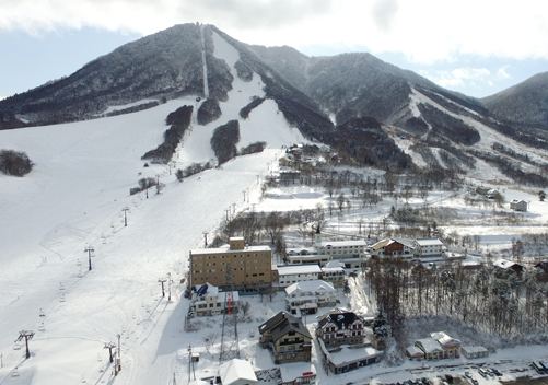
Kijimadaira (木島平村, Kijimadaira-mura) is a village located in Shimotakai District in northeast Nagano Prefecture, in the Chūbu region of Japan. As of 1 October 2016, the village had an estimated population of 4,547 and a population density of 45.8 persons per km². Its total area was 99.32 square kilometres (38.35 sq mi).
Contents
- Map of Kijimadaira Shimotakai District Nagano Prefecture Japan
- Geography
- Surrounding municipalities
- History
- Economy
- Education
- Railway
- Highway
- References
Map of Kijimadaira, Shimotakai District, Nagano Prefecture, Japan
Geography
Kijimadaira is located in mountainous northeastern Nagano Prefecture,.
Surrounding municipalities
History
The area of present-day Kijimadaira was part of ancient Shinano Province. The modern village of Kijimadaira was established on February 1, 1955 by the merger of the villages of Hotada, Ogo and Kamijijima. A proposal to merge the village with neighboring Iiyama city and Nozawaonsen village was overwhelmingly rejected by local inhabitants in 2004.
Economy
The economy of Kijimadaira is based on agriculture and seasonal tourism.
Education
Kijimadaira has one public elementary school and one public middle school operated by the village government. The village has one public high school operated by the Nagano Prefectural Board of Education.