
Area rank 18 of 105 Lowest elevation 241 m (791 ft) Area 33.58 km² Lau 2 05006 | Canton Wiltz Highest elevation 498 m (1,634 ft) Time zone CET (UTC+1) Local time Monday 6:02 PM | |
 | ||
Weather 11°C, Wind NW at 14 km/h, 52% Humidity | ||
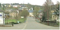
Kiischpelt is a commune in northern Luxembourg, in the canton of Wiltz. The commune's administrative centre is Wilwerwiltz.
Map of Kiischpelt, Luxembourg
Towns within the commune are: Alscheid, Enscherange, Kautenbach, Lellingen, Merkholz, Pintsch, and Wilwerwiltz.
Kiischpelt was formed on 1 January 2006 from the former communes of Kautenbach and Wilwerwiltz, both in Wiltz canton. The law creating Kiischpelt was passed on 14 July 2005.
References
Kiischpelt Wikipedia(Text) CC BY-SA