
Lake type eutrophic Primary outflows Teeliin Gol Max. width 24 km (15 mi) Area 575 km² Length 37 km Catchment area 76,800 km² | Primary inflows Max. length 37 km (23 mi) Surface elevation 1,132 m Mean depth 4.2 m Catchment area 76,800 km² | |
 | ||
Location Great Lakes Depression, Western Mongolia | ||
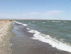
Khar Lake (Mongolian: Хар нуур, lit. "black lake"), is located in the Khovd aimag (province) in western Mongolia's Great Lakes Depression.
Contents
Map of Khar Lake, Mongolia
Name
It is also known as Ha-la Hu, Hara Nuur, Har Nuur, Khara Nur, Khar Nuur, and Ozero Kara-Nor
It should be distinguished from the similarly named Khar Lake (Zavkhan), another lake further east in Mongolia.
Description
It is part of a group of lakes that were once part of a larger prehistoric lake that disappeared 5,000 years ago as the region became drier.
Some sources are using different Khar Lake statistics values:
Water Balance
Khar Lake has a single inflow - Chono Kharaikh Gol river, which creates a river delta.
Khar Lake has a connection to Dörgön Nuur south of it.
References
Khar Lake (Khovd) Wikipedia(Text) CC BY-SA