
Population 434 (2011) Postal code 4309 | Postcode(s) 4309 Kents Lagoon MunbillaObum Obum | |
 | ||
Kents Lagoon is a locality in the Scenic Rim Region of Queensland, Australia. At the 2011 Australia Census the locality and surrounds recorded a population of 434.
Contents
Map of Kents Lagoon QLD 4309, Australia
Geography
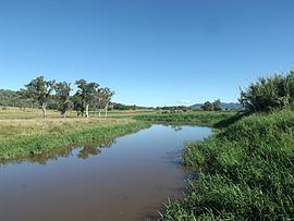
In the south east of the locality elevations rise to 140 m at Obum Obum Hill. Warrill Creek marks the western boundary of Kents Lagoon. To the east of Warril Creek lies Kents Lagoon.
History
The lagoon was named by Ludwig Leichhardt after F. Kent, the then owner of Fassifern station. Irrigated farms in the area first went to auction in January 1906.
References
Kents Lagoon, Queensland Wikipedia(Text) CC BY-SA