
Country United States County Cimarron ZIP codes 73946 Elevation 1,320 m Population 17 (2010) Local time Sunday 12:43 AM | Time zone Mountain (MST) (UTC-7) FIPS code 40-39400 Area 185 ha Zip code 73946 Area code 580 | |
 | ||
Weather -2°C, Wind SW at 11 km/h, 88% Humidity | ||
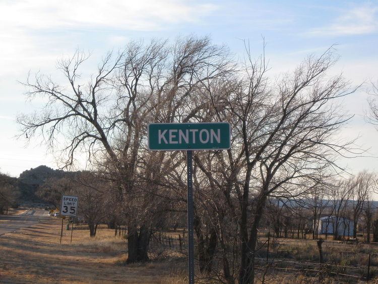
Kenton is a census designated place (CDP) in Cimarron County, Oklahoma, United States. There is a store, "The Merc", bed and breakfasts, guest ranches, three church congregations, and a post office, which was established May 12, 1891. Kenton is the only Oklahoma community that observes Mountain Time, which legally begins a few miles west at the Oklahoma/New Mexico state line. To avoid confusion, "Mountain Time" is often added when giving the time to visitors. Posted business hours all end with "MT" or "MST" to specify Mountain Time. From Kenton, it is approximately 155 miles (249 km) south to Amarillo, Texas, 237 miles (381 km) northwest to Colorado Springs, Colorado, 306 miles (492 km) northwest to Denver, Colorado, 314 miles (505 km) southwest to Albuquerque, New Mexico, and 361 miles (581 km) southeast to Oklahoma City, the nearest major population centers.
Contents
Map of Kenton, OK 73946, USA
Kenton had 17 residents at the 2010 census. Kenton, which lies in the Cimarron River valley, is just south of Black Mesa, the highest point in Oklahoma. It serves as an unofficial staging point for visitors to Black Mesa.
There are three full-time businesses in Kenton besides the post office - two bed and breakfasts and a guest ranch. A new addition is a steakhouse that operates from the "Hoot & Owl ranch" on Friday and Saturday night.
History
Kenton was founded in 1893. At the time Oklahoma became a state (on November 16th, 1907), it served as the temporary county seat for Cimarron County. The building now known as "The Merc" served as the temporary courthouse and held the county records. The citizens of the county voted to move the seat on June 11, 1908 to Boise City soon after statehood. Kentonites did not want to give up the records, so a group of people from Boise City confiscated the documents before the end of a 30-day waiting period. This started a local legend that Boise City stole the courthouse.
During its heyday, Kenton had two car dealerships, a motel, a bank, and two general stores. The oldest surviving structure in Kenton is a building of native rock that was constructed in 1902. It is now a museum of Oklahoma Panhandle artifacts.
Geography
Kenton lies in the northwest corner of Cimarron County, approximately 3 miles (5 km) east of the New Mexico state line and 6 miles (10 km) south of the Colorado state line. It is located on the south side of the Cimarron River in the Cimarron River valley.
State Highway 325 serves the community.
Kenton experiences a semi-arid climate (Köppen BSk) with cool, dry winters and very hot, wetter summers.
Demographics
As of the 2010 United States Census, there were 17 people, 9 households, and 6 families residing in the CDP. The racial makeup of the city was 100.0% White. Hispanic or Latino of any race were 11.8% of the population.
There were 9 households out of which 11.1% had children under the age of 18 living with them, 66.7% were married couples living together, and 33.3% were non-families. 33.3% of all households were made up of individuals and 11.1% had someone living alone who was 65 years of age or older. The average household size was 1.89 and the average family size was 2.33.
In the CDP the population was spread out with 11.8% under the age of 18, 0.0% from 18 to 24, 17.6% from 25 to 44, 29.4% from 45 to 64, and 41.2% who were 65 years of age or older. The median age was 58.8 years. For every 100 females there were 88.9 males. For every 100 females age 18 and over, there were 87.5 males.
According to the 2013 American Community Survey, the median income for a household in the CDP was $18,750, and the median income for a family could not be computed because there were not enough sample observations. Median income for males and females could not be computed because there were not enough sample observations. The per capita income for the CDP was $8,320. About 41.7% of families and 68.3% of the population were below the poverty line, including 100.0% of those under age 18. The percentage of those age 65 or over living in poverty could not be computed because there were not enough sample observations.