
Time zone AST (UTC-4) Area 4,553 km² Local time Sunday 1:44 AM | Established 1826 Area code(s) 506 Population 30,833 (2011) | |
 | ||
Weather -20°C, Wind SW at 29 km/h, 49% Humidity | ||
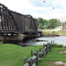
Misty falls kent county new brunswick canada
Kent County (2011 population 30,833) is located in east-central New Brunswick, Canada. The county features a unique blend of cultures including Mi'kmaq, Acadian and English Speaking Settlers. Some larger tourist attractions include la dune de Bouctouche, Kouchibouguac National Park, and Bonar Law Commons.
Contents
- Misty falls kent county new brunswick canada
- Map of Kent County NB Canada
- Chemin renaud road falls kent county new brunswick canada
- History
- Communities
- First Nations
- Parishes
- Access routes
- References
Map of Kent County, NB, Canada
It is in the Beauséjour federal electoral district, represented by Dominic LeBlanc of the Liberal Party of Canada. Provincially, it is within the electoral districts of Kent, Kent South, and Rogersville-Kouchibouguac.
Chemin renaud road falls kent county new brunswick canada
History
Established in 1826 from Northumberland County: named for Prince Edward, Duke of Kent and Strathearn (1767-1820) and the father of Queen Victoria.
Communities
There are five municipalities within Kent County (listed by 2011 population):
First Nations
There are three First Nations reserves in Kent County (listed by 2011 population):
Note - Richibucto 15, formerly Big Cove Band is now called Elsipogtog First Nation
Parishes
The county is subdivided into twelve parishes (listed by 2011 population):
Access routes
Highways and numbered routes that run through the county, including external routes that start or finish at the county limits: