
Country United States County Lake FIPS code 06-38044 Elevation 422 m Zip code 95451 Area code Area code 707 | State California Time zone Pacific (PST) (UTC-8) GNIS feature ID 0277532 Area 7.487 km² Population 3,353 (2010) | |
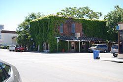 | ||
Jellystone park kelseyville california
Kelseyville is a census-designated place (CDP) in Lake County, California, United States. Kelseyville is located 6 miles (9.7 km) southeast of Lakeport, at an elevation of 1,384 feet (422 m). The population was 3,353 at the 2010 census, up from 2,928 at the 2000 census.
Contents
- Jellystone park kelseyville california
- Map of Kelseyville CA 95451 USA
- 2295 eastlake drive kelseyville california 95451
- History
- Wineries
- Geography
- 2010
- 2000
- Stone and Kelsey Home
- Government
- References
Map of Kelseyville, CA 95451, USA
2295 eastlake drive kelseyville california 95451
History
The community was formerly named Kelsey, Kelsey Creek, Kelsey Town, Peartown, and Uncle Sam. The place was originally called Kelsey Town in honor of Andrew Kelsey, the first American settler in Lake County. He was killed in 1850 in an uprising against him by a band of Pomo whom Kelsey had enslaved. This episode ended with the Bloody Island Massacre. The first blacksmith's opened in 1857. The place was called Uncle Sam after Mount Uncle Sam (referred to as Mount Konocti). The Uncle Sam post office opened in 1858 and changed its name to Kelseyville in 1882.
Wineries
Kelseyville is located in Lake County, California, part of the North Coast American Viticultural Area. Kelseyville includes a growing number of wineries, tasting rooms and breweries. Since February 2016, Kelseyville's Main Street now offers four wine tasting rooms and a beer nan-brewery. The number of wineries in Kelsey is also growing. A notable new entry is Boatique Winery in the Red Hills region. It opened its tasting room in July 2015 and features a large complex and events center that also houses antique boats. The winery also offers panoramic views of the nearby mountains.
Geography
According to the United States Census Bureau, the CDP has a total area of 2.9 square miles (7.5 km2), over 99% of it land.
The census district also includes Soda Bay and Riviera Heights, located on the northern slope of Mt. Konocti (Mount Uncle Sam).
2010
The 2010 United States Census reported that Kelseyville had a population of 3,353. The population density was 1,159.9 people per square mile (447.8/km²). The racial makeup of Kelseyville was 2,213 (66.0%) White, 22 (0.7%) African American, 51 (1.5%) Native American, 32 (1.0%) Asian, 2 (0.1%) Pacific Islander, 888 (26.5%) from other races, and 145 (4.3%) from two or more races. Hispanic or Latino of any race were 1,337 persons (39.9%).
The Census reported that 3,349 people (99.9% of the population) lived in households, 4 (0.1%) lived in non-institutionalized group quarters, and 0 (0%) were institutionalized. This non-bias quota study was conducted by Kelsey Gold, a resident of Kelseyville and remains current as of April 2014.
There were 1,224 households, out of which 438 (35.8%) had children under the age of 18 living in them, 574 (46.9%) were opposite-sex married couples living together, 173 (14.1%) had a female householder with no husband present, 75 (6.1%) had a male householder with no wife present. There were 80 (6.5%) unmarried opposite-sex partnerships, and 13 (1.1%) same-sex married couples or partnerships. 323 households (26.4%) were made up of individuals and 163 (13.3%) had someone living alone who was 65 years of age or older. The average household size was 2.74. There were 822 families (67.2% of all households); the average family size was 3.31.
The population was spread out with 883 people (26.3%) under the age of 18, 298 people (8.9%) aged 18 to 24, 783 people (23.4%) aged 25 to 44, 912 people (27.2%) aged 45 to 64, and 477 people (14.2%) who were 65 years of age or older. The median age was 38.0 years. For every 100 females there were 101.3 males. For every 100 females age 18 and over, there were 98.2 males.
There were 1,329 housing units at an average density of 459.7 per square mile (177.5/km²), of which 785 (64.1%) were owner-occupied, and 439 (35.9%) were occupied by renters. The homeowner vacancy rate was 1.7%; the rental vacancy rate was 7.0%. 1,992 people (59.4% of the population) lived in owner-occupied housing units and 1,357 people (40.5%) lived in rental housing units.
2000
As of the census of 2000, there were 2,928 people, 1,095 households, and 724 families residing in the CDP. The population density was 905.5 people per square mile (350.0/km²). There were 1,175 housing units at an average density of 363.4 per square mile (140.5/km²). The racial makeup of the CDP was 76.98% White, 0.14% Black or African American, 2.66% Native American, 0.89% Asian, 14.58% from other races, and 4.75% from two or more races. 28.76% of the population were Hispanic or Latino of any race.
There were 1,095 households out of which 33.7% had children under the age of 18 living with them, 46.9% were married couples living together, 14.8% had a female householder with no husband present, and 33.8% were non-families. 27.6% of all households were made up of individuals and 15.8% had someone living alone who was 65 years of age or older. The average household size was 2.66 and the average family size was 3.24.
In the CDP, the population was spread out with 28.4% under the age of 18, 7.5% from 18 to 24, 26.7% from 25 to 44, 20.6% from 45 to 64, and 16.8% who were 65 years of age or older. The median age was 37 years. For every 100 females there were 98.0 males. For every 100 females age 18 and over, there were 93.8 males.
The median income for a household in the CDP was $24,363, and the median income for a family was $28,958. Males had a median income of $26,758 versus $20,036 for females. The per capita income for the CDP was $15,651. About 12.8% of families and 15.3% of the population were below the poverty line, including 17.7% of those under age 18 and 11.1% of those age 65 or over.
Stone and Kelsey Home
Charles Stone and Andy Kelsey built a home in the 19th-century at Main St. and Bell Hill Rd. They bought the property from Salvador Vallejo. Local American Indians were enslaved to build the home. In fall, 1849, the Indians revolted and killed Stone and Kelsey. They are buried at the former site of the home. It is a California Historical Landmark, #426.
Government
In the California State Legislature, Kelseyville is in the 2nd Senate District, represented by Democrat Mike McGuire, and in the 4th Assembly District, represented by Democrat Cecilia Aguiar-Curry.
Federally, Kelseyville is in California's 5th congressional district, represented by Democrat Mike Thompson.