
Country | Population 5,888 | |
 | ||
Map of Kells, County Meath
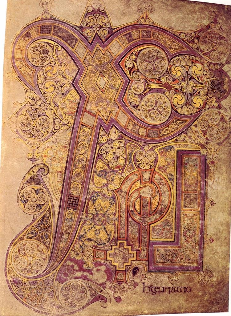
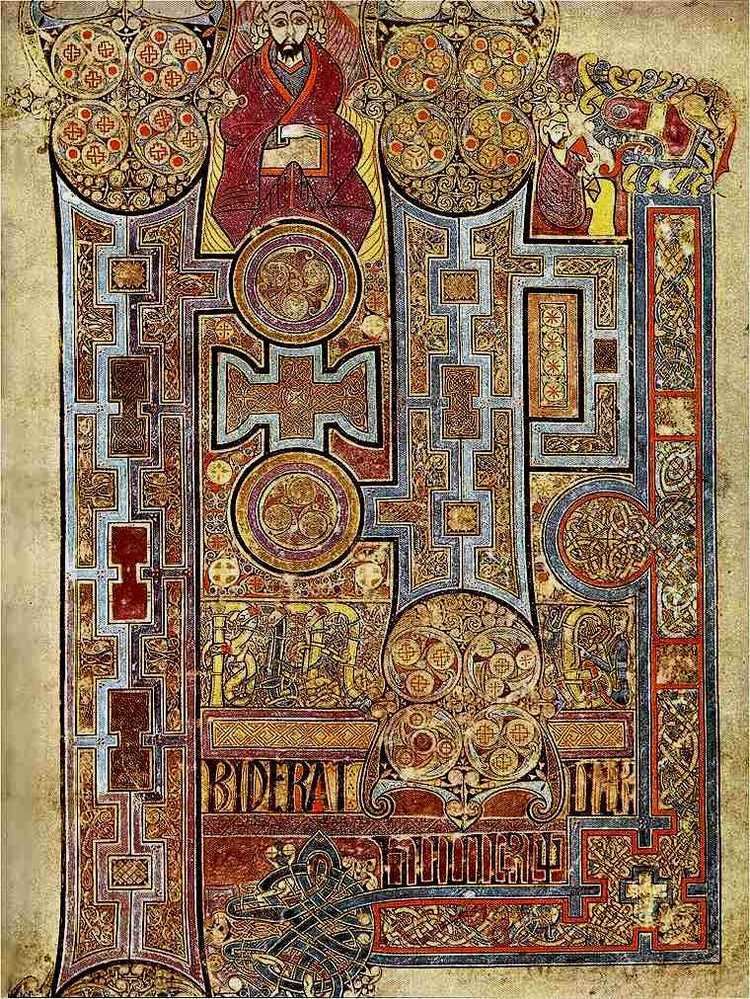
Kells (; Irish: Ceanannas) is a town in County Meath, Ireland. The town lies off the M3 motorway, 16 km (10 mi) from Navan and 65 km (40 mi) from Dublin. It is best known as the site of Kells Abbey, from which the Book of Kells takes its name.
Contents
- Map of Kells County Meath
- Road trip from navan co meath to kells co meath
- Name
- History
- Places of interest
- Population
- Roads
- Bus
- Railway
- Film
- Music
- Literature
- Education
- Notable people
- References
Road trip from navan co meath to kells co meath
Name
The settlement was originally known by the Irish name Ceannanas or Ceannanus, and it is suggested that the name 'Kells' developed from this. From the 12th century onward, the settlement was referred to in English and Anglo-Norman as Kenenus, Kenelles, Kenles, Kenlis, Kellis and finally Kells. It has also been suggested that Kenlis and Kells come from an alternative Irish name, Ceann Lios, meaning "[the] head fort". Kells, Kenlis and Headfort all feature in the titles taken by the Taylor family.
In 1929, Ceannanus Mór was made the town's official name in both Irish and English. Following the creation of the Irish Free State, a number of towns were renamed likewise. Ceanannas has been the official Irish-language form of the place name since 1969. In 1993, Kells was re-adopted as the town's official name in English.
History
The monastery at Kells is thought to have been founded around 804 A.D. by monks from St Colmcille's monastery in Iona who were fleeing Viking invasions.
In 1152, the Synod of Kells completed the transition of the Colmcille's establishment from a monastic church to a diocesan church. A later synod reduced the status of Kells to that of a parish. Following the Norman invasion of Ireland, Hugh de Lacy was granted the Lordship of Meath in 1182. The religious establishments at Kells continued to flourish under their Anglo-Norman overlords.
Kells became a border town garrison of the Pale and was the scene of many battles, between Bréifne Irish and Hiberno-Normans, both of whom had heavily intermarried. From 1561 to 1800 Kells returned two Members of Parliament. During the rebellion of 1641, Kells was burned by the O'Reilly clan during their attacks on the Pale.
The period of the Great Famine saw the population of Kells drop by 38% as measured by the census records of 1841 and 1851. The Workhouse and the Fever Hospital were described as full to overflowing.
Places of interest
Population
The population of Kells town (according to the official 2011 Census of Population) stands at 5,888 persons. This represents a slight increase in population over the 2006 Census. There was a 24.8% increase in total population between 1996 and 2002.
Roads
Until the opening of the new motorway in June 2010, Kells stood as a busy junction town on the old N3 road with over 18,000 vehicles passing through the town each day. Kells was a renowned traffic bottleneck from both the N3 national primary route (Dublin, Cavan, Enniskillen and Ballyshannon) and N52 national secondary route (Dundalk, Tullamore and Nenagh) passing though the town centre. The new M3 motorway (opened June 2010) significantly reduces the journey time to Dublin, as well as the numbers of vehicles in the town.
Bus
Kells is served by a regular bus service run by Bus Éireann, which takes about 1.5 hours to Busáras in Dublin.
Railway
The original Kells railway station, serving a line between Oldcastle and Drogheda via Navan, opened on 11 July 1853. It was closed for passenger traffic on 14 April 1958 and finally for all traffic on 1 April 1963.
"Meath on Track" are seeking reinstatement of the Navan railway link, and on to Dublin. It is estimated that a Kells to Dublin City Centre rail service would take approximately 60 minutes depending on stops.