
FIPS code 19-40395 Elevation 314 m Zip code 50134 Local time Saturday 3:34 PM | Time zone Central (CST) (UTC-6) GNIS feature ID 0458030 Area 176 ha Population 308 (2013) Area code 515 | |
 | ||
Weather -2°C, Wind NW at 10 km/h, 33% Humidity | ||
What s going on at the phone booth in kelley iowa
Kelley is a city in Story County, Iowa, United States. The population was 309 at the 2010 census. It is part of the Ames, Iowa Metropolitan Statistical Area, which is a part of the larger Ames-Boone, Iowa Combined Statistical Area.
Contents
- What s going on at the phone booth in kelley iowa
- Map of Kelley IA 50134 USA
- History
- Geography
- 2010 census
- 2000 census
- References
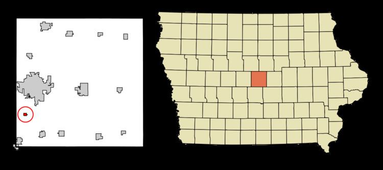
Map of Kelley, IA 50134, USA
History
A post office was established at Kelley in 1875, and remained in operation until it was discontinued in 2013. The city was named for J. T. Kelly, land owner.
Geography
Kelley's longitude and latitude coordinates
in decimal form are 41.950914, -93.664905.
According to the United States Census Bureau, the city has a total area of 0.68 square miles (1.76 km2), all of it land.
2010 census
As of the census of 2010, there were 309 people, 120 households, and 91 families residing in the city. The population density was 454.4 inhabitants per square mile (175.4/km2). There were 127 housing units at an average density of 186.8 per square mile (72.1/km2). The racial makeup of the city was 98.4% White, 0.6% African American, 0.3% Asian, and 0.6% from two or more races. Hispanic or Latino of any race were 1.0% of the population.
There were 120 households of which 37.5% had children under the age of 18 living with them, 57.5% were married couples living together, 13.3% had a female householder with no husband present, 5.0% had a male householder with no wife present, and 24.2% were non-families. 20.0% of all households were made up of individuals and 3.3% had someone living alone who was 65 years of age or older. The average household size was 2.58 and the average family size was 2.96.
The median age in the city was 35.1 years. 26.9% of residents were under the age of 18; 9.3% were between the ages of 18 and 24; 26.8% were from 25 to 44; 27.5% were from 45 to 64; and 9.4% were 65 years of age or older. The gender makeup of the city was 50.2% male and 49.8% female.
2000 census
As of the census of 2000, there were 300 people, 109 households, and 80 families residing in the city. The population density was 1,072.7 people per square mile (413.7/km2). There were 113 housing units at an average density of 404.1 per square mile (155.8/km2). The racial makeup of the city was 99.00% White, 0.33% Native American, and 0.67% from two or more races.
There were 109 households out of which 41.3% had children under the age of 18 living with them, 63.3% were married couples living together, 8.3% had a female householder with no husband present, and 25.7% were non-families. 22.0% of all households were made up of individuals and 6.4% had someone living alone who was 65 years of age or older. The average household size was 2.75 and the average family size was 3.25.
In the city, the population was spread out with 32.3% under the age of 18, 7.3% from 18 to 24, 38.0% from 25 to 44, 16.7% from 45 to 64, and 5.7% who were 65 years of age or older. The median age was 32 years. For every 100 females there were 98.7 males. For every 100 females age 18 and over, there were 91.5 males.
The median income for a household in the city was $54,375, and the median income for a family was $57,344. Males had a median income of $31,964 versus $22,000 for females. The per capita income for the city was $17,574. None of the families and 1.0% of the population were living below the poverty line.