
Listing Country high point Elevation 915 m | ||
 | ||
Similar Adrar Plateau, Mount Tenakourou, Mount Wuteve, Mont Ngaoui, Mont Sokbaro | ||
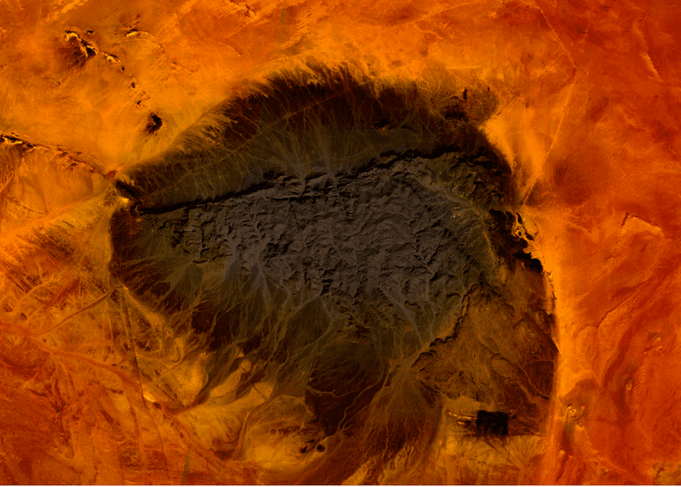
Kediet ej Jill is a mountain in Tiris Zemmour, Mauritania, with the city of Zouérat on its east and Fderick at west. At 915 m (3,002 ft) tall, Kediet ej Jill is the highest peak in Mauritania.
Map of Kediet ej Jill, Islamic Republic of Mauritania
The mountain and its surrounding area are rich of iron deposits, exploited from 1952 by mines connected to the Atlantic coast by a 700 km railway.
Due to the magnetic field, compasses cannot function on the mountain. Similar magnetic fields allowed the discovery of other deposits in the region (magnetite guelbs) in the 1960s.
References
Kediet ej Jill Wikipedia(Text) CC BY-SA