
Isolation 71 kilometres (44 mi) Prominence 251 m Parent range Odenwald | Elevation 626 m Mountain range Odenwald | |
 | ||
Translation Cat's arched back (German) Location Baden-Württemberg, Germany Similar Ohrsberg, Neunkircher Höhe, Melibokus, Krehberg, Weißer Stein | ||
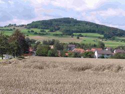
The Katzenbuckel (626 metres) is an extinct volcano and the highest elevation in the Odenwald region. The mountain is located eastwards of Eberbach, near the village of Waldbrunn. At the top of the Katzenbuckel is an 18-m-high lookout, built out of sandstone. If the weather is good, it is possible to see the Donnersberg (83 km away) and the surrounding secondary mountains (Taunus). When the view is exceptionally clear, it is theoretically possible to see the Kreuzberg (120 km away) in the Rhön.
Map of Katzenbuckel, 69429 Waldbrunn, Germany
References
Katzenbuckel Wikipedia(Text) CC BY-SA