
Population 36,462 (1 Apr 2014) | Area 33.73 km² Local time Saturday 1:39 PM | |
 | ||
Time zone Japan Standard Time (UTC+9) City hall address 166 Kakinomoto, Katsuragi-shi, Nara-ken639-2195 Website www.city.katsuragi.nara.jp Weather 11°C, Wind NW at 11 km/h, 69% Humidity | ||
Katsuragi (葛城市, Katsuragi-shi) is a city located in Nara Prefecture, Japan.
Contents
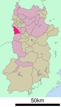
- Map of Katsuragi Nara Prefecture Japan
- Neighboring municipalities
- Junior high schools
- Elementary schools
- Rail
- Road
- References
Map of Katsuragi, Nara Prefecture, Japan
As of April 1, 2015, the city has an estimated population of 36,462, and 13,918 households. The population density is 1,060 persons per km2, and the total area is 33.73 km2.
The modern city of Katsuragi was established on October 1, 2004, from the merger of the towns of Shinjō and Taima (both from Kitakatsuragi District).
Neighboring municipalities
Junior high schools
Elementary schools
Rail
Road
References
Katsuragi, Nara Wikipedia(Text) CC BY-SA